Cycling routes
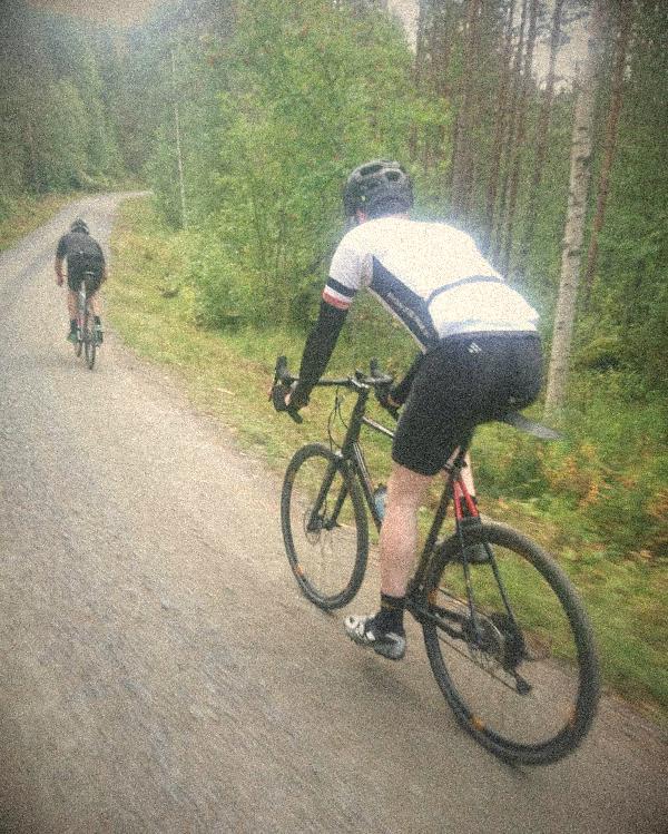
The gravel event is just one day and only shows a small part of all the wonderful cycling that is around. We have therefore put together some suggestions on gravel bike routes in the Storuman area (and some asphalt routes too), which can be used for exercise and training, or for touring. These are by no means exhaustive, and you can of course combine the routes together, shorten, extend, move start and finish and so on. We hope it will inspire to some epic rides.
Below the maps there are links to an external site with the routes on interactive maps and files you can load into your GPS.
Some of the routes can be quite tough (a lot of climbing etc), so check out the elevation profile and the map to see if the route suits you before you go.
Two favorites
With such a rich selection of routes, it can be difficult to know where to begin. Therefore we’ve selected two of our favorites for you who may be an experienced cyclist but have not tried gravel biking before:
These two are a good representation of what gravel biking is all about. Choose a day with nice weather and dry roads. There’s a huge difference between riding on a dry hard gravel road and one that is soft and muddy, and we of course want your first impression of this wonderful sport to be good.
Short and nearby
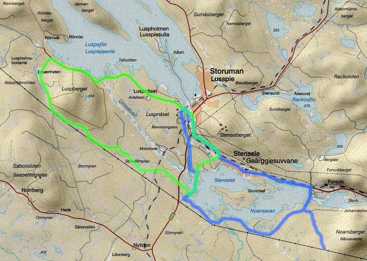
Although the best areas for gravel biking are a few kilometers outside town, there are possibilities to make routes that start inside Storuman and are not too long. As it is paved near the urban area, both asphalt and gravel are mixed in these routes. The map presents two examples.
One route goes along low-traffic paved Kungavägen to Ensamheten, and then the old gravel road back. You have to lift the bike over the railway (watch out for trains!), and then you ride over the old bridge towards Stensele and the cycle path back. It will be 26 km, of which about half is asphalt.
The other route goes around Noansavan with an optional climb up Noansberget, and then Stensele and back. It will be 28 km, almost half on gravel.
If you want to cycle shorter and stay closer within town, you can also make a ride as a mix between cyclocross and crit racing, which is about cycling shorter segments around town, cycle paths, ordinary streets, paths, illuminated ski tracks randomly combined in an improvised route. This of course becomes a bit jerky riding and is not suitable for large groups. You have to have very good awareness of the traffic around and show consideration, but it’s a playful, fun and varied form of cycling. The nature of this style of riding becomes a bit more technical and tricky so it’s not suitable for GPS-guided routes, therefore we do not give any examples here.
Interactive maps with GPS files below:
Gravel routes west
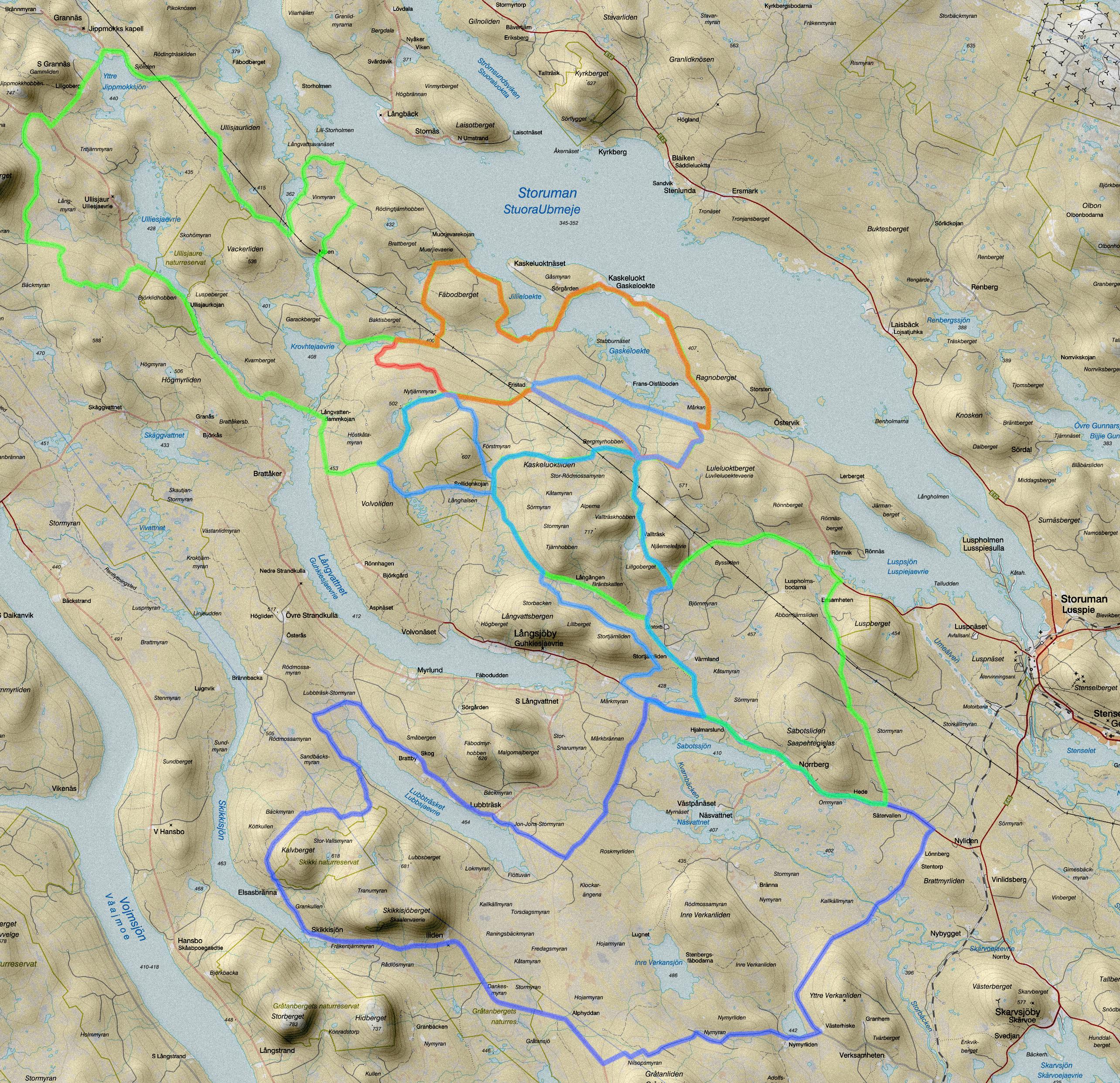
To the west of Storuman towards Vallträsk, actually the whole area south of lake Storuman, is the most flexible area in terms of being able to put together a large number of different routes. There are many gravel roads that are connected so you can get around in several ways without getting into a dead end.
In addition to normal lengths, the examples include really long routes up to 200 kilometers for a full day out for the experienced cyclist, or a couple of days for those who bring camping gear.
A special route in the list is Lönnberg – Skikkisjön – Lubbträsk, in such a way that the roads are not connected. At Kalvberget there are a few hundred meters of machine path that you can steer the bike past. At Gråtanliden you have to get through a little forest with a more or less visible path though, so it is preferable if you have a light bike that you can carry (such as a cyclocross or gravel bike).
A really nice A-to-B ride (or tour-retour) a bit further away is to cycle along the gravel roads from Slussfors to Tärnaby or Hemavan. The last kilometers will be on asphalt, but the rest is fine low traffic gravel roads through small villages surrounded by increasingly alpine mountains.
Interactive maps with GPS files below:
Gravel routes south-east
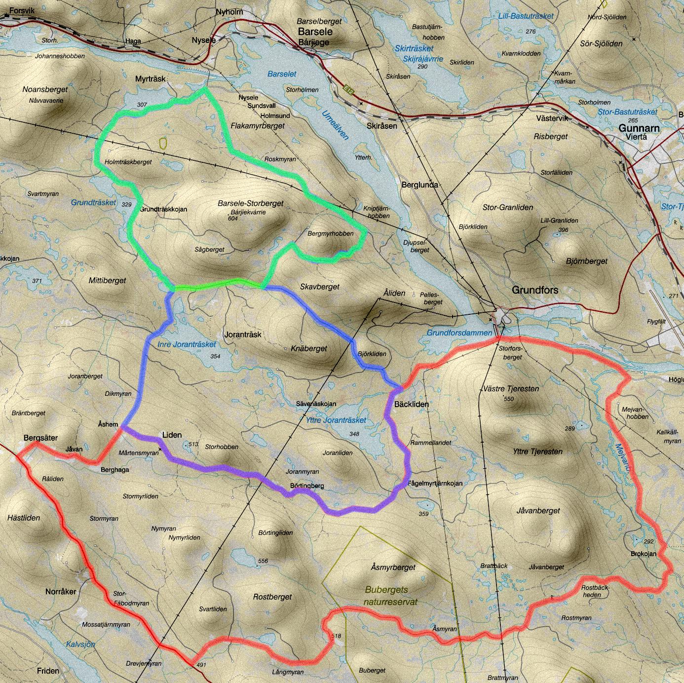
Two routes at Barsele-Storberget and Joranträsken are shown here. One shorter at 25 km, and one longer at 48 km. Start and finish are at a large parking lot on Myrträskvägen directly after the bridge over the river, 16 km from Storuman. The passage over the mountain next to Barsele-Storberget is steep. It doesn’t require an MTB but it will be hard to do for touring bikes.
The longer route has a really long uphill towards Åshem, but then you get everything back again in a nice fast mellow and curvy downhill towards Bäckliden.
South of those route is a longer one, Bergsäter – Buberget, which is 62 km. We have placed start and finish at a parking located at Hästlidmyran between Skarvsjöby and Pauträsk near Bergsäter.
Interactive maps with GPS files below:
Gravel routes east
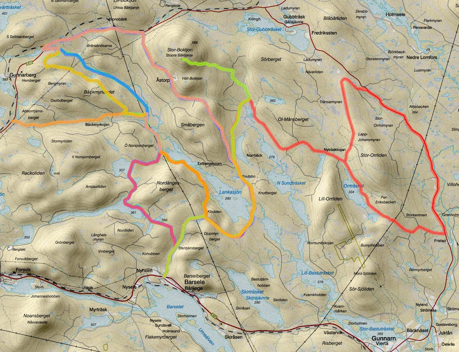
Several of these example routes start in Barsele, about 20 kilometers from Storuman. On some of the routes you need to pass some asphalt, but it's worth it. A good start is the first route passing Åstorp, and then riding along Gunnarbäcken and the lakes Norsjorn and Ansjaur.
Interactive maps with GPS files below:
- Barsele – Lankasjön – Åstorp
- Barsele – Gunnarbäcken
- Barsele – Stororrliden – Nordängesberget
- Barsele – Stor-Boktjon
- Abborrtjärnsberget – Lankasjön
Gravel routes north
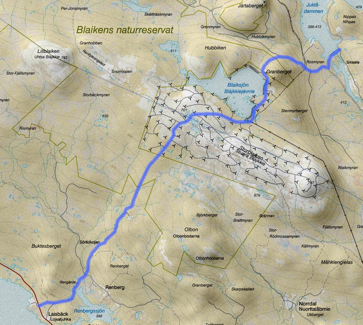
Northwest of Storuman (north of Lake Storuman), alternatives are more limited as the gravel roads are often dead ends, and the paved E12 with its heavier traffic is not as pleasant to ride on.
There are still some tours that are definitely worth doing. Cycling from Laisbäck up the high mountain to the wind farm not least. If you fancy a longer ride and don’t mind some asphalt you can ride down the other side of the mountain towards Juktån and ride all the way around and come back on the E45.
Interactive maps with GPS files below:
- Laisbäck – Juktådammen
- Storuman – Storblaiken – Juktån
- Storuman Forever eco-driving (half is asphalt)
- Blaiken gruva och vind
- Mattaberget runt (requires porting)
- Mattaberget – Vinberget (requires porting)
Riding on asphalt
If you are craving to ride on paved roads with the road bike it’s possible to do of course. However, there aren’t as many roads to choose from, and the major roads E12 and E45 are not very pleasant to ride because of some fast and heavy traffic.
Fortunately, there are some low-traffic paved roads too, and most are hilly enough to provide good variety even if you ride tour-retour.
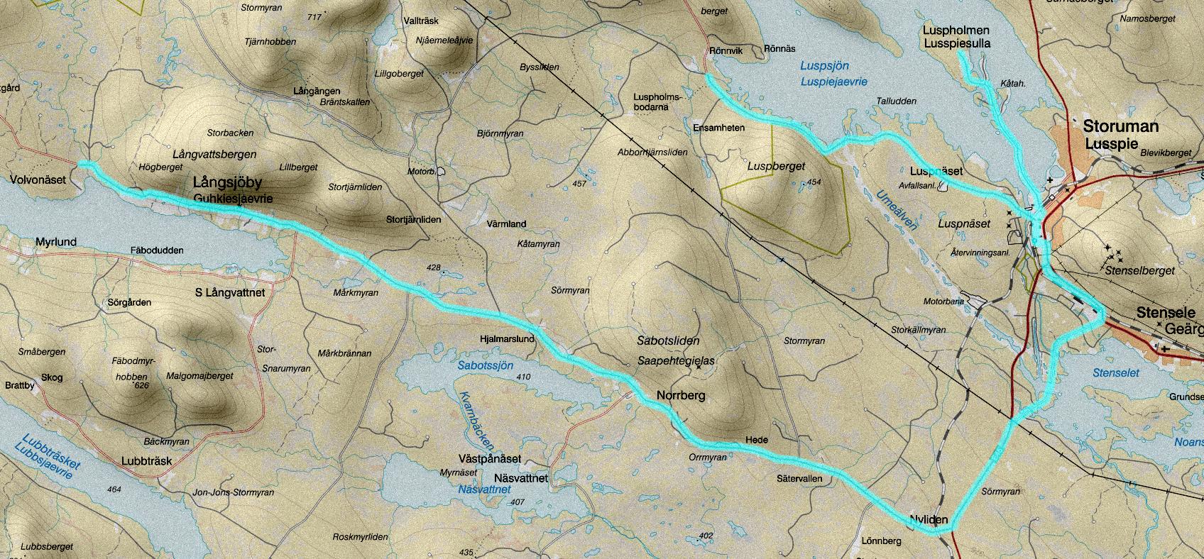
The route in the picture links the distances Storuman – Luspholmen, Storuman – Kungavägen (the paved part), and Storuman – Långsjöby via Stensele, a total of 88 km.
Another very nice and low-traffic road is the “Gubbträsk road”, the road between Gunnarn and Gubbträsk. It will be 54 km round trip. You can start at whatever end you want, but the common start is in Gunnarn, where you can park at the grocery store. Both E45 and E12 are wide and nice between Storuman and the Gubbträsk road so you can ride all the way around without any problem (it will be 85km). It’s also possible to connect tour-retour Gunnarn – Åskilje north of the river, a road that is paved and has almost no traffic.
The road between Ankarsund and Sorsele has relatively little traffic and offers substantial climbing. A tour-retour ride will be 125 km. If you start from the Ankarsund side you can take a coffee or lunch break in Sorsele, halfway into the ride.
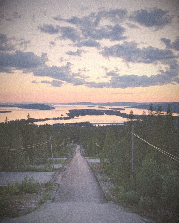
Don’t forget that the road up to the viewpoint inside Storuman is paved, and it has gradients over 10% — a real challenge — and you get rewarded with a beautiful view from the tower at the top.
Interactive maps with GPS files below:
- Storuman low-traffic asphalt
- Gubbträskvägen
- Gunnarn – Åskilje – Gubbträsk
- Ankarsund – Sorsele tour-retour
- Gubbträskrundan
Making own routes
Tips for making your own routes:
- Check the route profile and put the start / finish and direction as it suits. Many people experience short steep uphills and long mellow downhills as more pleasant than the other way around, and it can be nice if the end of the route is easier.
- If you want to drive by car to the start, look at aerial photos to find a sutiable spot for parking. It is often possible to find areas suitable for parking even in the middle of nowhere.
- A hilly route feels completely different when riding it in the opposite direction, so do not be afraid to make tour-retour routes or insert small detours. It won’t feel repetitive.
- Sometimes, by porting the bike just a few hundred meters after a trail or over a clearcut, roads can be linked together which otherwise would require a detour of many miles to get around. By the way, carrying and even running with the bike is an established part of the related genre cyclocross, so it’s not a strange thing to do.
- Avoid high traffic gravel roads (dust and stone shot from cars are not so nice), then rather include a section of asphalt.
- In the spring or after heavy raining, the gravel roads can be very soft and make the riding heavy and slow.