What is Storuman Gravel XL?
Storuman Gravel XL is an ultra distance gravel event over a 450 km (280 miles) long course through forests and mountains in the municipality of Storuman and Hemavan-Tärnaby (in Swedish Lapland), with or without an overnight stay halfway. The course runs on mostly gravel roads of varying quality (83%), with short connecting segments on asphalt scattered in-between (17%).
The XL event is separate from the conventional Storuman Gravel event. It takes place on the same weekend, but has its own start time and place and its own rules. All information about this event is on this page.
All participants are self-supported and join as individuals, but you can choose to ride together if you like. The course is available on file and shows the recommended shortest route between the course’s checkpoints that must be passed in given order. Halfway through you find yourself in Hemavan and can spend the night there (hotels exist), if you want to split the event into two days (2 × 220 km / 140 miles).
The event is a lightweight arrangement without course markings and depots, and uses public and private roads open to traffic as usual. There is no service on the course and the participant is self-responsible for safety and transport, for example if quitting. It’s not a formal competition and doesn’t follow the format of any sports organization, but is a challenge for those who want to test their strength over a really long cycling distance in a relaxed context. Race timing and live tracking is included, but there are neither prices nor placements awarded.
Quick info:
- Event name: Storuman Gravel XL.
- Course: 450 km, 5600 m elevation gain, 83% gravel, 17% asphalt.
- Date: August 1-2, 2026.
- Signup: only in advance online through the signup page.
- Start: Storhälla, Storuman, Sweden, Saturday 06:00, registration from 05:15.
- Finish: Utsikten, Storuman, Sweden, no later than Sunday 22:00 (that is max time is 40h).
- Format: self-supported participants (packing is required), unmarked course, navigation with navigator, optional overnight stay halfway, tracker devices with livetrack, own responsibility for safety and transport.
- Classes: men, women and tandem-bike.
- Race timing: total time and per stage, see prior results.
The event organizer is Luspholmens Arrangörsförening.
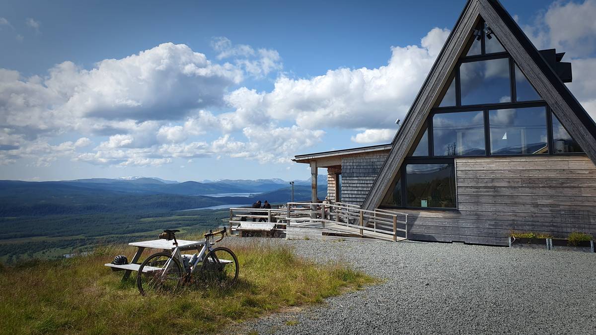
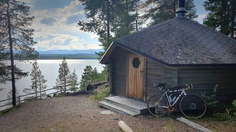
Stage 1 finish (224 km) at Björk, Hemavan. Can only be reached by walking, bike or lift. The bike in the photo lacks packing bags, and is thus not equipped for this event.
Contents
Compared to most gravel events, there is an unusual amount to read here. The purpose is to make it accessible to beginners and answer all sorts of questions, but also experienced riders should look through the page to know how to do the event and what equipment is required.
- Rules — the event format and its rules.
- The course — description of the course in text, diagrams and maps.
- Join — join the event!
- Results — new and old results from the event.
- Equipment and packing — the equipment and packing required to participate.
- Before, during and after — things to consider before, during and after the event.
- Navigation — files for navigation and how to configure your navigation device correctly.
To mitigate the information overload, we have collected tips and curiosities last, if you are not interested, you can skip this:
- More about navigation — less important but potentially interesting about navigation.
- How tough is the time limit? — some calculation examples of how fast you need to ride.
- Tips about equipment and packing — also includes nutrition and water access.
Rules
Like many other ultra-distance events, Storuman Gravel XL has own rules to be able to offer a concept tailored to the conditions for this particular place. The rules are designed to make it possible to complete the event in several ways:
Rövattsliden, 208 km into the course. Norra Storfjället in the background.
- The whole event in one go, or
- the event split into two stages, where you have the chance to replenish during the overnight stay, and
- ride solo or together, where for example an experienced cyclist rides together with a less experienced.
To make it simple the class division is however basic: men, women and tandem-bike. You therefore don’t need to specify in advance how you intended to do your event, and in the results list afterwards both total time and stage times are shown for each participant separately.
(Note: if you choose to ride together in a pair you still sign up each on your own, the tandem class is for tandem bikes, two people on one bike. It's unusual with tandem participants, but we like tandem bikes so of course we have a class for it and hope each year that someone actually signs up for it.)
Even if it’s not a formal competition, some participants focus on making a good result and want well-defined rules so the performance becomes comparable, while others who only aim at completing the event may find the rules a bit unnecessarily detailed, but we need to consider both interests. At the core it’s still simple: follow the course and record your route using your navigator, don’t litter, and pack the bike to be self-supported.
The rules are as follows:
- The participant must be self-supported, but commercial services (restaurants, grocery stores, gas stations, etc) may be used, with no prebooked arrangements.
- The participant is responsible for recording their route to secure a result. This as backup if the tracker device malfunctions. The recording is requested only if needed.
- The event is completed in one go or with one overnight stay. Overnight stay is defined as at least 5 hours consecutive rest, normally in Hemavan, but the place can be chosen freely.
- Those that stay overnight may prepare for the next day as if it’s a separate event. “Overnighters” thus may in connection with the rest, and only then, change packing and equipment and partake of food and other things which don’t belong to regular commercial services.
- Equipment: helmet, first-aid-kit, reflectors and lights for the dark, mobile phone, navigator and extra clothing for the weather are required. Aerobars for ultra-distance is allowed. If riding together, only one navigator is required, but it’s recommended that everyone has one.
- The packing must be brought all the way, only garbage may be discarded (in appropriate bins). If riding together, others in the group may carry parts or all your packing.
- Littering is absolutely prohibited. The course runs in an especially sensitive environment with privately owned roads and lands.
- It’s allowed to have personal helpers on standby to help with problems, and that they are out cheering here and there along the course, but they must otherwise stay passive. Helpers should only be used for increased safety and possibly morale, not as a method to directly improve performance.
- It’s allowed to get help from outside to get the bike or other equipment repaired or replaced in case of breakdown.
- It’s allowed to get a ride to and from the same place on the course in connection with the overnight stay, or for repairs or other emergency measure.
- It’s allowed with an occasional emergency delivery, for example due to forgotten equipment or honestly misjudged packing. This must not be abused as a strategy to reduce the packing.
- Occasional “pleasant stops” are allowed, such as a coffee break at a friend’s place who lives along the course, or accepting a treat from a bystander. This must not be put into system to save packing and time.
- Drafting between participants is allowed, that is riding close behind another cyclist in order to be shielded from the wind to save energy.
Overnighters may restock without restrictions
When you are out riding on the course, you may only use regular commercial services. If you don’t stay overnight, it counts as riding the whole time, so then for the entire event you are limited to the commercial services that exist if you want to stock up on food and other things.
The end of the climb at Gethobben on the way to Nipen, 364 km into the course.
If you instead stay overnight, you can however consider the event as being two independent stages, one after the other, and you can prepare for the second stage without restriction, just like before the start of the event. You can therefore, if you want, ship food and equipment to your accommodation in Hemavan (or send via post), to supplement or replace the commercial services.
This relief can of course be used to save a few hundred grams of packing on the bike, or to add a change of clothes for more comfort. It’s however mainly there so that those who happen to have accommodation in or around Hemavan can use it and what’s there fully without risking breaking any rules. It’s also intended to make the event more accessible and convenient for those willing and able to use this relief.
If you intend to spend the night but don’t have the ability to solve the logistics yourself, you have to make do with the commercial services available on site. The grocery store in Hemavan is well stocked, so what you miss out are mainly change of clothes and other conveniences. If you feel that it’s unfair, we recommend that you instead go for completing the event in one go, as it then will be equal for everyone.
Normally, the overnight stay is made in the gap inside Hemavan between the two official stages, for example at Hemavans Fjällcenter. If you make your stay outside the gap, you either have to get back to the start of the stage after your overnight stay, or the resulting time for the stage you spent the night on will suffer.
It’s allowed to get a ride to and from your accommodation for the overnight stay. When getting a ride from and to the course, you must be dropped off at the same place where you were picked up, so the entire course is cycled. If you in connection to the overnight stay get a ride from and back to the gap between the stages, it’s a bit relaxed however, for example if you are picked up at the grocery store and dropped off at the bath house the next day, it’s okay.
Helpers on standby
Several of the participants travel to the event by car together with friends or family, and the course, because it’s curled next to a paved country road, is perfect for helpers in cars to be out on the course and cheer on and help. It contributes to safety and morale, so we don’t want to prevent it, but at the same time unrestricted personal support would mean that the event would be much different, and unfair to the participants who come to the event alone, who are several as well. Therefore, the rules put restrictions on what helpers are allowed to do out on the course.
The principle is simple: helpers (car-borne or not) may only move in and help in case of problems, they may not be used as a tactical advantage. In other words, if everything goes normally without mishaps, it shouldn’t make any difference if you had access to helpers or not, other than possibly a boost in morale.
It’s allowed for the helpers to be out on the course and cheer here and there and convey information about the situation on the course, as long as they otherwise remain passive. The car should not follow the cyclist closely throughout the course like a support car, but rather drive to suitable locations and wait until the cyclist passes.
Keep in mind that not the entire course is drivable by car, and some parts, although drivable, are unsuitable for driving. You should stick to the somewhat bigger roads. (It’s worth noting that it’s not possible to drive all the way to Björk, that is the finish for stage 1.)
Of course, we want everyone to pack their bike with the same margins as you have if you don’t have the opportunity to be picked up by a car, so don’t be tempted to reduce the packing, for example skip the rain jacket, just because you know a helper can come to the rescue.
We also want to encourage helpers out on the course to cheer on all participants, not just their own cyclist, and if you as a helper find yourself in a situation where you can help another participant who is having a problem, we would love for you to do so.
Pleasant stops
Some of the participants usually have some kind of connection locally, and maybe have a friend who lives or has a cabin along the course who wants to offer a coffee break. Maybe someone who is interested in the event has made something similar to a depot and offers passers-by coffee and buns.
Although taking part in something like this is technically support and would break the self-supported rule, we allow it as an exception in the rules, because we want the participants to be allowed to have a good time along the course. The important thing is not to use this exception as a tactic to save time.
It’s even okay, for example, to plan a full dinner at a friend’s house who lives down the road, but if you do this type of larger “personal support” then it should also be matched with staying for a longer time, for example a good hour, so that it becomes apparent that the stop doesn’t result in a time saving by being able to take less food on the bike.
It’s by nature of course a bit fuzzy where the line is between a “pleasant stop” and performance enhancing personal support. If you aim to get around as quickly as possible, we therefore recommend that you avoid this type of stop, especially if it’s are arranged just for yourself.
Interaction with the locals
It has happened that participants who have had problems have knocked on the door of residents along the course and asked for a place under roof to rest. It’s not directly against the rules, but of course it can be problematic if this happens frequently. We don’t want to be known locally as an event that creates a mess and burdens residents in the area, and in the long run it can lead to problems with our permits. Therefore, we ask everyone to be well prepared to be fully self-supported out on the course.
There are also three places for safety stops along the course, see separate section on safety shelters, so even if you get into trouble despite all your preparations, you should not have to involve residents along the course.
Race timing
The following three time results are recorded:
- Total time from start at Storhälla to finish at Utsikten in Storuman.
- Stage 1: time from start at Storhälla to Björk top restaurant in Hemavan.
- Stage 2: time from the exit of Hemavan to the finish in Storuman.
The main goal is to make it around the entire course before the maximum time of 40 hours expires. Within that, each participant can choose whether they want to ride fast, and if so either try to get as short a total time as possible, or use the opportunity to sleep over in Hemavan and instead focus on fast stage times. The sum of stage 1+2 is also presented in the results list, which thus excludes the gap in Hemavan and any overnight stay that was made there.
You could thus say it’s two races in one. One that is 450 km long, and one divided into two 220 km long day stages. You don’t register in advance how you intend to do it, so you can change your mind during the course of the event. Storuman Gravel XL is not a formal race and we do not say which of the times is more prestigious, instead we want you to adapt your plan to what suits you best.
The race timing works as follows: for the start at Storhälla it’s the time of the start that applies, so if you arrive late you lose time. For the stage 1 finish, start stage 2, and total finish in Storuman, we do an analysis of the recorded track afterwards and determine as precisely as possible when the participant crosses a predetermined virtual line on the course. The time can be further rounded and grouped together if there are several who cross the finish line together. Finally, the time is published rounded (upwards) to the nearest minute.
For race timing with virtual lines to work well and give precise results you need to pass them at speed (for those familiar with Strava: just like Strava segments). For the stage finishes, it’s important to get all the way up the finishing climbs and properly into the flat parking lot at the top before stopping to relax. For the start of stage 2, it’s important to start riding a fair bit before the starting point and have a flying start past.
Each participant is given a tracking device for livetrack, and the time is primarily calculated from that recording. However, the tracking devices cannot be guaranteed to be 100% reliable, so you as a participant is responsible to record your route with your navigator, and if necessary, the track is requested after the finish so that the time can be derived from that.
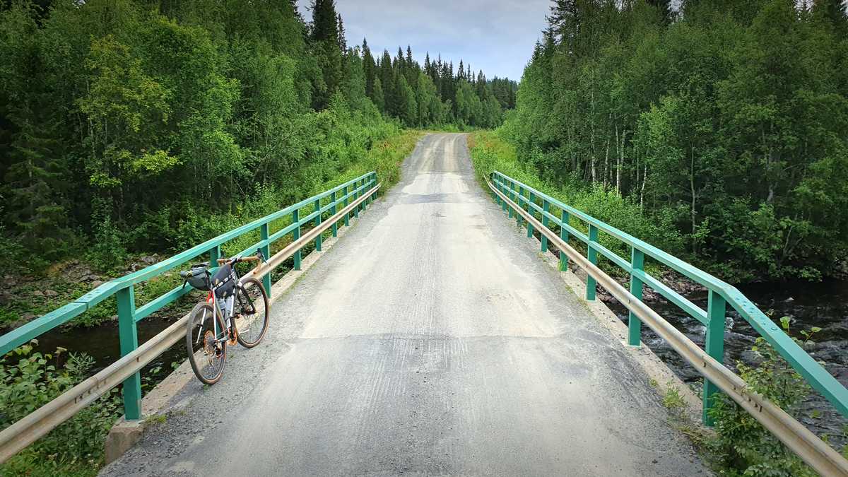
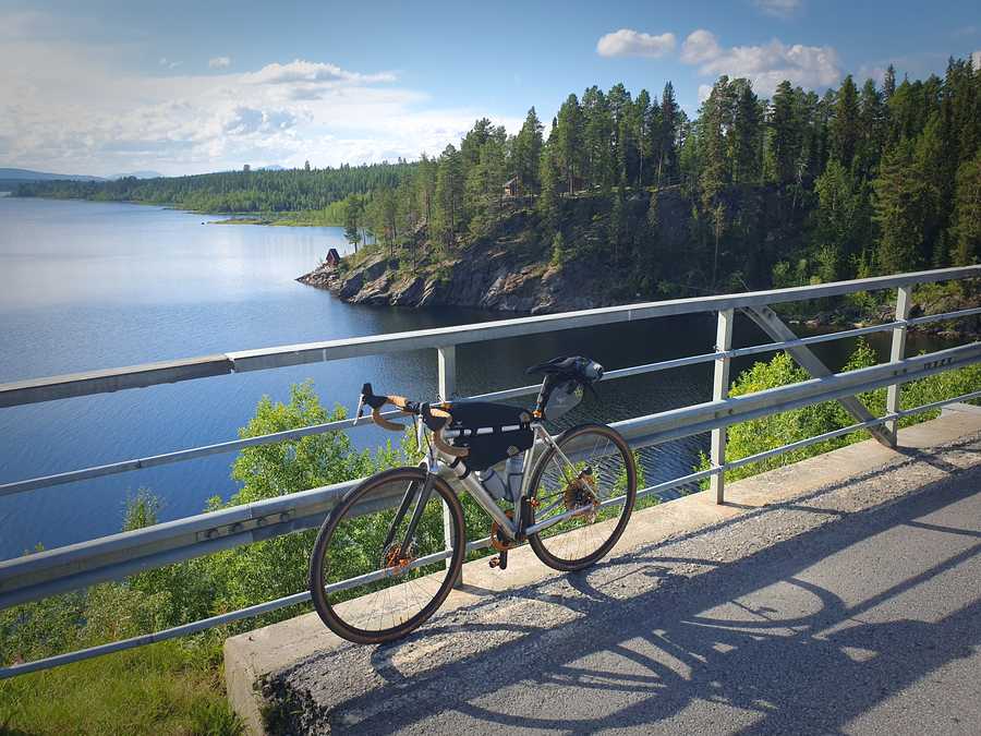
Bridge over Långvattsbäcken, 356 km into the course.
The course
The basis of the event is the course. Had it not been possible to find a nice course layout, there wouldn’t be an event.
The course is designed with the aim of achieving as good and varied gravel cycling as the area can offer. Near Storuman there is roads deep in the forest and among low mountains, with gradually higher mountains the closer you get to Hemavan. Lots of wilderness, nice views, small villages and lonely farms here and there. The character of the course changes, there are both easy flat and tough hilly sections, both fairly smooth well-maintained gravel roads and bumpier rarely used forestry roads.
83% of the course consists of gravel roads with low or extremely low traffic, of varying character and surface quality. As it’s not possible near the mountains and larger villages to completely avoid asphalt, there are some shorter connecting segments on that surface. A total of 11% of the course is on paved minor roads, and 6% on paved country roads (E12 / E45), of which the longest section is 10.5 km (between Gardikfors / Forsmark and Ajaureforsen). Most of the paved road sections run close to the mountains so there’s scenic surroundings and less traffic than typical for a country road.
The course diagram below with elevation profile is possible to zoom and pan. The map in the background is moved along with the profile automatically. The map is schematic, but both the course track and the elevation profile is fully detailed.
The course contains approximately 125 meters of elevation gain per 10 km, which can be said to be hilly without being extreme. For comparison, Vätternrundan contains 43 meters per 10 km. To those that has tried our Storuman Gravel 116 km course, we can say that the surface and profile are similar to that, so the XL course is about as tough as riding the 116 km course four laps.
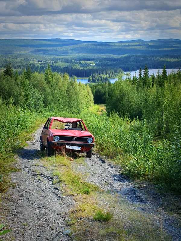
Älsoliden, view towards Sparmanselet, 325 km into the course. Illustrates how shaky the rarely used forest roads can be at their worst on the downhill slopes after a rainy summer, and that you must always be prepared for unexpected obstacles, like this car wreck.
In two places, at Dajkanberg and Grannäs, there is a shorter “crux” (about 1 km each), where there’s off-road track rather than proper road. They are rideable, though overgrown and / or bumpy so you can’t ride at much speed.
For being a gravel course, it can in parts be experienced as somewhat technical. This is due to occasional steep slopes both uphill and downhill, where especially the downhill slopes can be shaky due to erosion. During the day it’s not a problem to manage, but those who intend to ride through the night need a very strong headlight to be able to ride at speed. Some of the roads are also more overgrown than you might be used to from other events. There is a wide span between the smoothest and the roughest gravel roads along the course.
The course apparently doesn’t follow the shortest route between Storuman and Hemavan, and especially towards the end there is much back and forth over the mountains with a lot of climbing. With more than 300 km in the legs it can feel tough that the course doesn’t go straighter, even though the gravel riding is actually very nice in that area. We have strived to offer nice views, but also that the course should be tough and decisive, and towards the end that will be felt. The fact that the course is convoluted over a smaller area also makes it safer, since considering its length it’s still relatively quick and easy to reach different places by car.
Technically, the course is defined as passing a number of checkpoints in the correct order, which is the traditional way of constructing unmarked long courses since the time before satellite navigators. However, the checkpoints are virtual, neither marked or manned and can be in the middle of nowhere. The idea is to pre-load the route into your navigator, and then you are guided by that around the course, so there’s no element of manual navigation as long as the navigator is working.
If you are curious to see exactly where the checkpoints are positioned, they are marked in the map below (which you can zoom and pan). However, if you just follow the pre-loaded track you don’t need to know where they are.
Join
The registration is made in the same place as for the regular event, on the signup page.
This event takes place on the same weekend as our conventional Storuman Gravel event (with course lengths between 30 and 116 km), so if it suits, you can bring a bunch of cycling friends with you and there will be a course length that suits any desire and ability.
Kirjesån at the outlet of Nedre Boksjön, 299 km into the course. Relatively easy cycling slightly downhill for 16 km towards Slussfors awaits.
Equipment and packing
You will need the following equipment and packing:
- Bike:
- Recommended tire width 40 mm or more. Slicks or narrower than 35 mm is not recommended.
- Aerobars for ultra-distance is allowed.
- Reflectors (or corresponding reflective tape) and basic lights are required. A tail light with daylight function is recommended also during the day when riding on country roads.
- If you intend to ride through the night you will need an extra bright headlight (1000+ lumens), to be able to ride safely at speed on rough roads.
- E‑bikes are not allowed.
- Electronics:
- Bike computer or equivalent device with the ability to guide the cyclist along a pre-loaded course. Used for recording the route and navigation around the course. Correct settings in the navigator is more important in this event than many other due to the course complexity. See separate section about navigation.
- Mobile phone. Please check your operator’s coverage map in advance. If you have an exotic mobile subscription, it may be advisable to get a prepaid card with better coverage. Roaming will work too.
- Battery bank capacity to be able to use the navigator and mobile phone throughout the event.
- If you are cycling together, it’s enough for one person in the group to have a navigator, but we recommend that everyone has one. Everyone must have a phone (in case someone quits, etc.).
-
Food/energy:
- Water bottles, minimum capacity for 1 liter, preferably more in hot weather. There are good opportunities to refill from streams and lakes here and there.
- Food/energy of preferred type to get around. If you plan to stay the night in Hemavan, see details of what is available and adapt.
- Electrolyte supplement. Due to the length of the event, salt deficiency due to sweating is common.
-
Miscellaneous:
- Bike helmet.
- First aid kit. There are many good ready-made kits made for biking or hiking, they are compact and weigh 150 – 300 grams.
- Bike repair equipment: at minimum gear to fix numerous punctures and a mini tool to tighten screws.
- Adjust clothing according to weather, and have margin for the weather becoming worse and colder than the forecast shows.
- Ability to pay for food, accommodation, bus ticket etc.
- Recommended: if you don’t know the area, it’s nice to have a paper map as a backup if the electronics fail. It may also come in handy when to find alternative routes back if you need to quit the event.
- Recommended: SOS alarm’s 112 app.
- Recommended: an offline map as a mobile app (complements a paper map), such as MapApp Topo.
If you want some examples and ideas of how the equipment and packing may look, there is a separate bonus section: Tips about equipment and packing.
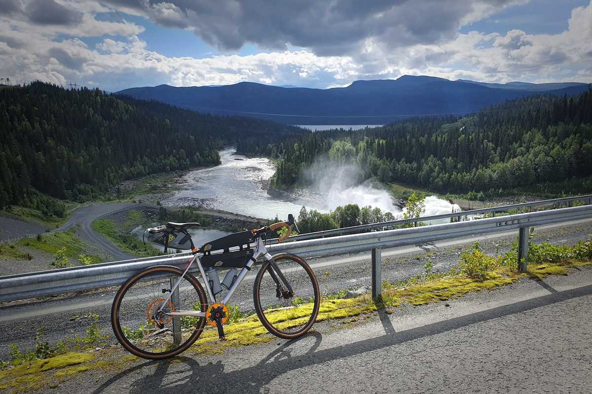
Dam at Ajaureforsen, 165 km into the course.
Before, during and after
Accomodation
In Storuman we recommend Storuman’s Camping as accommodation, and there you get also a full 30% discount as a participant in Storuman Gravel (XL or any of the regular events). Register for the event first, and then book via email and write there that you will participate, then you will get the discount.
About 174 km into the course, near Rönnbäck.
In Hemavan we recommend Hemavans Fjällcenter. If you plan to split the event over two days, you should book in advance. If you have planned to complete the event in one go but get problems and need to sleep over, you can book on site, and there is a phone number to call if you arrive outside of normal reception hours. However, the stand-by staff cannot receive payment for the room, so it must be done online or you have to wait until reception opens in the morning.
The centre offers both hotel and hostel standard. If you need a self-catering kitchen, choose the hostel option, and remember to add bed linen to your booking. There is a restaurant connected to the hotel, but check when booking whether the opening hours suit your needs.
If you want to take your bike into your room that is fine, but of course it must be reasonably clean. A water hose is available at the water station within the premises, see the map for Hemavans Fjällcenter & Camping. There is also a water hose at the gas station.
There are also more accommodation options and Storuman’s official visitor guide is a good source information for accommodation and food in Storuman, and Hemavan-Tärnaby’s official visitor guide the same for Hemavan. Note that summer is off-season for Hemavan so there are fewer alternatives than during winter.
Start
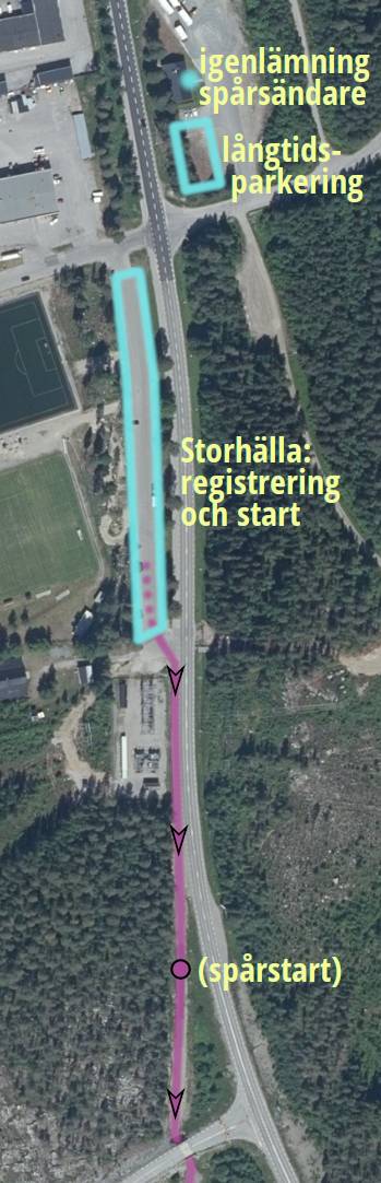
The start is held in the large long narrow car park (200 × 15 meters) at Storhälla multi-arena inside Storuman. Pretty unsexy place, but practical and safe from traffic if there would be somewhat large amount of participants, hence the choice. The course starts in direct connection to the cycleway towards Stensele. The navigation file start (0 km) and first checkpoint is a little further down the cycleway, marked with “track start” in the picture, but the start line will be in the parking lot.
If you want to park a car for a long time near the start we recommend the gravel surface (not the asphalt) on the south side of IT4U’s office building (Blå Vägen 210). Should you just park temporarily for the start there will be plenty of space in Storhälla’s parking lot.
The event doesn’t use number tags, but you register at the start so we know who is actually participating. In connection with that, you are also given a tracker device which means you will be visible on a public web map live throughout the event. If the finish is manned when you reach it, you can leave the tracker device there, otherwise you can leave it in the deposit box at the entrance to IT4U’s office.
Registration and assignment of tracker devices is done from 05:15 there at Storhälla’s parking lot. The start time is at 06:00 and all participants start simultaneously.
There are no toilets or changing room in the area, so come ready to start. Make sure your navigation device has the appropriate settings and has the course pre-loaded, otherwise it can be stressful to get everything ready just before the start.
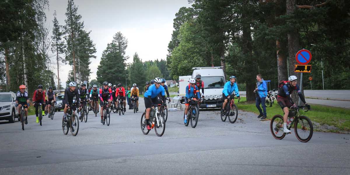
The start at Storhälla at 06:00 on Saturday morning. The photo is from the first year Storuman Gravel XL was held, that is 2024. This year the event was limited to only 25 participants of which 24 showed up, and 18 made it to the finish.
Following the course
The course is completely without course markings, so you must be fully guided by your own navigator pre-loaded with the course. Formally, the course consists of a number checkpoints that must be passed in the correct order, while you may choose any path you like between them. However, the recommended route consists of the nearest/best route between the checkpoints so there’s nothing to be gained from deviating from it, unless one has some errand, such as cycling to a place to stay the night.
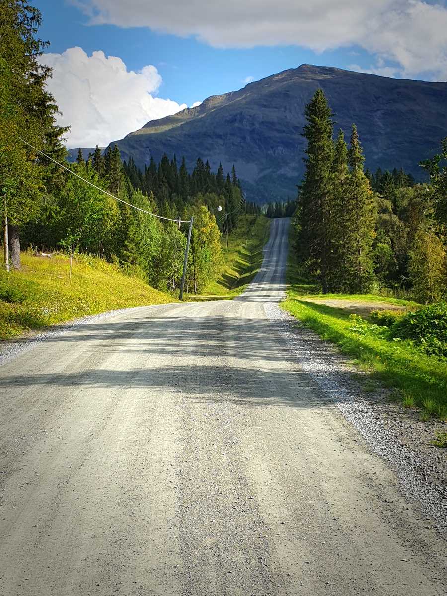
Nipen, 366 km into the course.
If you intend to deviate from the recommended route, study the map in advance so you know where the checkpoints are and plan the route accordingly. If you intend to follow the recommended route all the way (as almost all do), you don’t have to worry about where the checkpoints are.
Since well-functioning navigation is a very important part to have a good experience out on the course, we have a dedicated section about navigation, where you also find our official navigation files for download.
Don’t forget to record the route! To ensure that you get a result, you must have a recorded route, as the tracker devices are not 100% reliable. It’s fine to split up the recording, for example stop it at a meal break and start a new one when you continue.
Not all bike computers can record the entire distance on one charge, so you may need to bring a power bank for it.
In the unlikely event that an obstacle appears that you cannot get around, call us organizers and we will help find an alternative route. Of course, you don’t need to call if you can find an alternative route yourself that still passes the checkpoints in order.
Gates
One of about three lowered boom barriers along the course (be prepared for more!), here at Silverberget 108 km in.
At a few places along the course, there are gates that are normally closed. Many more open gates will be passed, so you have to be prepared that any of them can be temporarily closed. At the gates (they are in the form of boom barriers), you can simply get off the bike and crouch under or walk around.
The event has the consent of all the affected private road owners and landowners, and a road gate doesn’t automatically mean that bicycles are banned either, so you don’t have to feel like a crook when you bypass one.
(At the time of writing, the barrier on the road up to Björk has incorrectly a vehicle prohibited sign, it should actually be motor traffic prohibited. As a cyclist, you can ignore it.)
Water
You will need to fill up on water now and then. The area along the course is sparsely populated and there are no larger agriculture or industries so you can see it as nature and make use of the old rule about water in nature here up north: if it flows and is clear, it’s drinkable, and to that you can add clear surface water from the lakes.
There are plenty of streams and lakes to fill up on water from. For you that want to plan in a bit more detail there is more information in the bonus section water access.
Riding at night
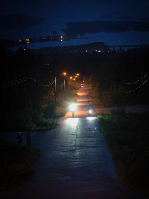
On the way to the finish at Utsikten Storuman, close to midnight under dense cloud cover. The photo illustrates how dark it can get for a few hours during the night.
The event is held in late summer, the days are still long this far up the globe, but the sun is below the horizon between about 22:00 and 04:00, and 00:00 - 02:00 it’s basically pitch black, especially if there’s cloud cover.
If you split the event into two days, you will probably avoid riding in the dark. You still have to bring a light for safety, but the front light doesn’t need to be powerful, that is it’s sufficient to make you visible to other road users, but not strong enough to ride fast on bumpy gravel roads.
If you however plan to ride through all or part of the night, you need a very powerful headlight (1000+ lumens). The later part of the course contains quite a lot of fast downhill on less maintained roads, which especially if it has been a rainy summer can be rough. It becomes difficult and risky to ride these if you don’t have good lighting so you can clearly see the road surface at speed. Try it during training, you may need a stronger light than you think. To make it through the night, the brightest mode should last for two hours, and a further two hours at somewhat lower power.
All in one go or spend the night?
We give everyone the opportunity to ride the course all in one go, and you don’t have to register in advance how you intend to do it. Originally, this opportunity was intended to attract participants with a very high capacity to ride fast, and/or experienced ultra cyclists accustomed to long days and tough conditions. However, we know from experience that even regular participants can choose to aim for this, and perhaps embark on this type of challenge for the first time. We have nothing against that, but ask that you think it through carefully and be prepared for the fact that it might not go as planned.
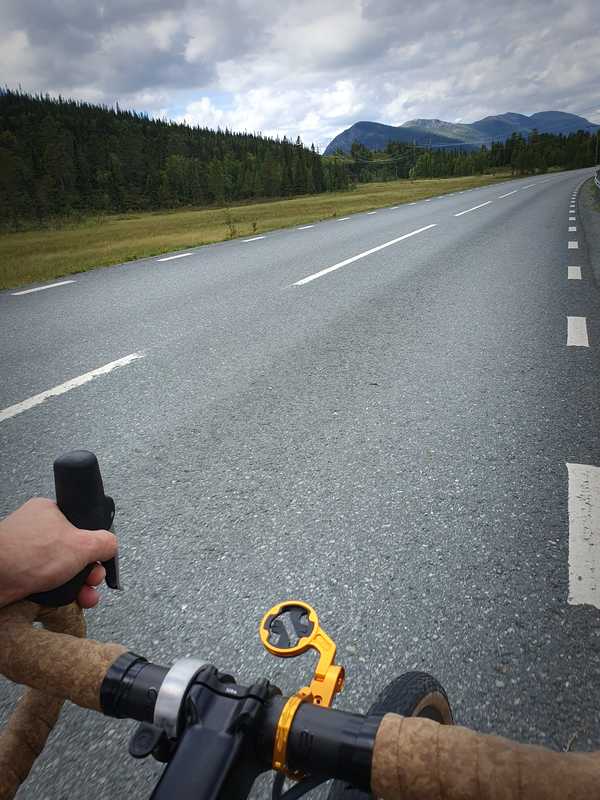
The course contains 17% asphalt, of which 6% country road, like here Blå Vägen after Gardvik, 163 km into the course.
- Be properly prepared for riding in darkness at speed on poor surfaces.
- It becomes even more important to pack clothes and equipment for unexpectedly rough weather. It’s recommended to have a bivy bag or equivalent with you.
- It’s common that those who ride all in one go still need to sleep for a couple of hours, and then you need suitable equipment to be able to do so. The open cabin Portbrostugan 320 km in can be a suitable place to snooze for a few hours.
- It’s desirable (but not a requirement) to be able to call a helper who can come to the rescue by car in the middle of the night if the challenge proves too tough. The organizer evacuates if someone is injured or in danger, but the car is reserved for only extreme situations.
The start time on the first day is the same for all participants to provide more of a race-like feel and to increase the chance of finding someone equally strong to ride together with, and it’s early in the morning to give everyone the chance to make it to Hemavan before the grocery store closes and darkness falls. If you belong to the category of participants who ride really fast but still want to spend the night halfway, there will thus be a lot of waiting before bedtime in Hemavan. So you either have to try to enjoy hours of calm and rest, or instead change strategy and make the event all in one go.
Bad weather
Few cyclists like rain. If we look at our previous organized events, the weather is good about 80% of the time, and when it is bad, it is rarely really bad all the time. Even if the weather is more often nice, it can of course be bad, and as a participant you need to be prepared for that, and you should have tested your equipment in poor weather during training.
The roads of course becomes softer and rolls worse in wet weather, but most hold up decently. The exception are the cruxes with offroad tracks where some sections can become so muddy that you have to walk, but it’s only 2 km of 450.
Due to the low number of participants and the fact that most people need a long time in advance to prepare for this type of event, it is particularly important that those who sign up for this are serious. It is simply difficult to find replacements for late dropouts. If you are very sensitive to the weather, you should therefore not sign up for this event.
Livetrack
Audience and friends back home may want to see where the participants are out on the course during the event, and for that we have livetrack. Even as a participant, it can be interesting to take out your mobile phone and check the livetrack website to see where the others are.
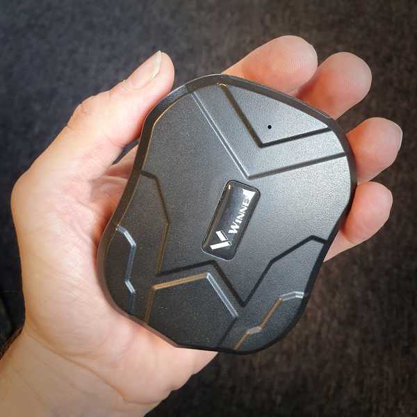
Tracker device (weight about 150 grams) which is loaned at registration and must be brought around the course.
We use a mobile phone app for this purpose in our shorter events, but it’s not reasonable for such a long event as this is, as mobile phones are not reliable enough (background tracking + battery optimization = trouble) and the tracking function consumes way too much power to be up and running for a couple of days. Therefore we instead have dedicated tracker devices that we distribute at the start.
The tracker devices transmit via the mobile network (4G), and since there is radio shadow here and there, the marker in the map can be stuck for a while sometimes, but be patient, it will (almost always) recover. However, 100% reliability cannot be guaranteed.
The live map is the one embedded higher up on this page, and the direct link is https://xlt.it4u.net/sumgvlxl (there is also an easy-to-remember short link leading to the same destination: xlt.it4u.net/xl). The live map is accessible and active all year and shows the course with its checkpoints, but only when the event is on there’s someone to follow in the map.
By pressing the participant’s marker on the map, it’s shown how far the participant has come on the course and how far there is left, and also when the participant is expected to arrive at the finish line (ETA, Estimated Time of Arrival). By tapping anywhere on the course, the ETA is calculated instead to the marked position on the course, which can be useful for spectators who are out and about on the course. ETA calculations for cyclists cannot be very accurate, but from experience we can say that it usually works quite well up to about 100 km or 4 - 5 hours. ETA is only shown when the participant is on the course and has been there for at least a few minutes.
Accommodation and food
If you want to spend the night in Hemavan, we as said recommend Hemavans Fjällcenter, see the general Accommodation section for details.
Storberg, 94 km into the course.
Opening hours for restaurants and the grocery store in Hemavan can change at short notice, so be sure to check the days before. Likely there are one or two restaurants that are open until 19:00, and the grocery store (ICA Nära Fjällboden) is probably open until 21:00. The grocery store is relatively large and well-stocked thanks to the border trade, pretty much everything a hungry cyclist could possibly want is there, except technical supplements like gels.
Those who ride the race in one go must only use permanent commercial services, and the grocery store in Hemavan is then the obvious stop. It’s located directly next to the course in the Bayhill Center.
If, on the other hand, you stay overnight (at least 5 hours of continuous rest), you can recharge between the stages without restriction, so you can have pre-placed food, but with 15 hours from the start until the grocery store closes, most people can count on getting there in time and can choose to buy food in place instead. For residents at the Fjällcenter hostel, there is a self-catering kitchen that you can use to prepare food, so you don’t have to bring your own cooking gear if you don’t want to. For the hotel alternative there is a restaurant, but be sure to check that the opening hours suits you.
Inside Hemavan, the only checkpoint on the course is to make sure you have made your way up to Björk’s top restaurant. The top restaurant usually has neither suitable food nor opening hours for this event, the finish for the first stage being there is of course for its great location.
In Slussfors there is a small often unmanned store with a basic grocery selection, Slussforsboa, where you can enter via Swedish BankID from 6 – 24, via the HonestBox app (can be installed on site). The app offers some alternatives to Swedish BankID so that foreign citizens can also enter with a compatible identification. Since it is a small store, there is a greater risk that opening hours will suddenly change, so don’t make any long-term planning based on being able to replenish there.
Finishing
Finish Utsikten Storuman, around 20:00 Sunday, two hours before the max time expires.
The final finish is at Utsikten in Storuman. We strive to be on site and welcome everyone but cannot guarantee we will be there, for example if something unexpected happens out on the course that we need to respond to.
The tracker device should of course be returned. If we are there at the finish, we can pick it up there, otherwise there is a deposit box by the entrance door to the IT4U office building (Blå Vägen 210, near the start) where you leave it. If you forget to return it, you can post it to us afterwards at the following address: “Luspholmens Arrangörsförening, c/o IT4U Sweden AB, Blå Vägen 210, SE 923 31 Storuman, SWEDEN”.
If you have finished the event in time and if you want, you can buy a Finisher T-shirt marked with the year of the event. We share the link to the webshop via email afterwards, where there are different types, colors and sizes to choose from. They are sold without profit.
Normally we calculate the times for the results list from the tracker device recording, and do so soon after the finish. However, these trackers are neither completely reliable nor accurate, and if we cannot derive a result with good quality, we will contact you and ask for your own recording from your navigator (in GPX, TCX or FIT format). If you didn’t have a tracker device at all (for example arrived late to the start), then of course you always have to send in a track, but even among those who had a tracker device it might fail and then we need the participant’s own recording.
In order for a GPX file to be used for race timing, it must contain timestamps, and if you only share an activity on Strava for example, the GPX file you download as a visitor will not contain any. So to share the file with us, you first need to log in yourself and download the GPX, TCX or FIT file locally to your computer, and attach it in an email to us.
Keep in mind that it can be dangerous to drive a car directly after a hard effort like this when you can be dehydrated, be at risk of getting muscle cramps and be tired in general. Just as Vätternrundan, we strongly recommend that you rest for at least six hours after reaching the finish line before driving a car. It’s against Swedish law to drive a car when tired.
Quitting the event
We don’t have any officials on the course, so if you quit you are fully responsible yourself for getting home. The event is meant to be an adventure to test your limits, so we don’t mind if you take a chance and make an attempt although you think there is a big risk that you won’t be able to finish, as long as you have ensured that you can get home.
If you quit, you must text, email or call us so we become aware of it. We prefer texting.
If you get to the finish of stage 1 but then feel that it’s time to quit, you will of course get a result for the completed stage, so not all is lost.
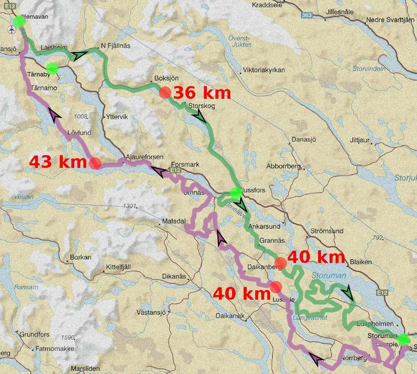
If you have to quit and cannot be picked up by a friend, you need to get to a bus stop on the E12 and go by bus back. Bus stops are available in Hemavan, Tärnaby and Slussfors, and the bus passes 2 - 5 times a day (see time tables). This means that there may be a long distance to the nearest bus stop (up to 43 km, see picture) and long waiting time at them.
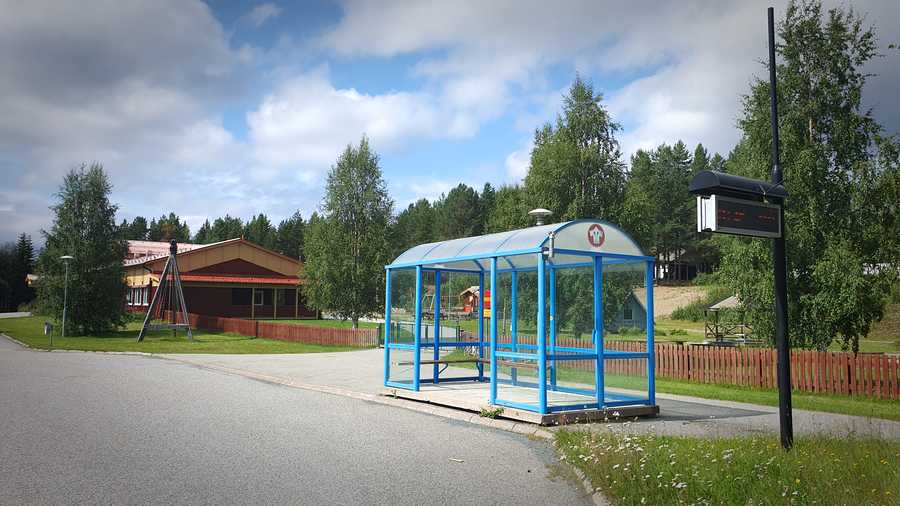
The bus shelter at Slussfors school, 317 km into the course. Also easy to reach halfway on the first stage.
Portbrostugan, open cabin at Portbron (near Slussfors and Umnäs), suitable for a pleasant break or emergency overnight stay under cover. 320 km into the course, also easy to reach from the halfway point of the first stage.
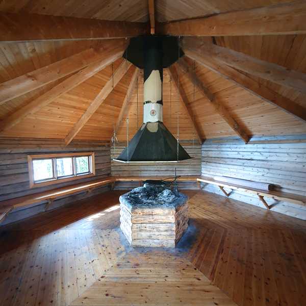
Fireplace and benches inside Portbrostugan.
Portbron, 320 km into the course. Portbrostugan among the trees on the headland in the background.
If you want to bring your bike on the bus, it’s only allowed on buses with cargo space (it may happen that individual bus drivers are more flexible, but nothing we can promise). At the time of writing, it’s about half of the departures that have that.
There is a taxi company in the area, Slussfors Taxi. The company is very small and availability in terms of general taxi operations varies, but you can always try calling. Keep in mind that a taxi journey with the distances involved can cost several thousand SEK.
Hopefully you won’t have to quit due to a complete breakdown, so you can at least ride back home slow and steady. Then it’s a good thing to have a map so you can see where it’s possible to make a short cut, and there are many opportunities for that.
Along the E12 there are only 144 km between Hemavan and Storuman, so if you feel on the second day that you can’t handle another whole day, maybe you still can manage to ride back along the E12. As a road bike route, it’s actually rather nice. If you reach halfway on day 2, that is to Grannäs, and there feel that you want out, there’s only 46 km to Storuman if you pick the closest route, and 105 km with lots of elevation if you follow the course to the finish.
We as organizers have a car on standby for evacuation, but it is reserved for (non-urgent) injured participants to be taken to the emergency room in Tärnaby or Storuman, for example if you have crashed and broken your collarbone. For urgent emergencies, it’s 112 that applies, of course.
If the bike breaks down and you don’t manage to fix it, and you don’t have a helper in a car who can come and pick you up, then it will potentially be several hours of walking to the nearest bus stop. It is troublesome and boring but not dangerous, and therefore the evacuation car should not be called. If you are worried about this scenario, you should try to talk to other participants before the start who have helpers out on the course who might be able to come to the rescue.
The reason we as organizers do not provide a taxi service for the participants quitting the event is not only the difficulty of finding officials who are prepared to provide themselves and their car on call for 40 hours, but also because we believe that the risk of being stranded makes participants more serious about the challenge, and prepare better.
Safety
All participants must be aware that they are out on a personal bike ride, and must be responsible for their own safety just as if on an own private long ride. Be aware that the mobile phone coverage on certain parts of the course is limited. On the gravel roads used by the course there is very little traffic, along some sections no cars pass at all. The course runs for the most part in very sparsely populated areas. In other words, you need to be prepared to handle rough situations by yourself.
Älsoliden, view over Umnässjön towards the mountains in the west, 324 km into the course.
If you have a relaxed attitude towards your own safety, then keep in mind that it’s also about avoiding to become a burden on other participants, the organizer and in the worst case emergency operations. During an event, the risk increases that an accident occurs, simply because there are more people out simultaneously. The theory of probablility tells us that if the accident risk per person is 1% and there are 50 participants, there is a 39% risk that at least one has an accident. Therefore, we ask each participant to reduce their own risk to need external help as much as possible.
Being stranded on the course is not normally dangerous, but the risk of consequential problems such as hypothermia increases. You must therefore be able to repair your bike in the field yourself, or arrange for your own pick-up (or repair assistance).
In the event of an emergency, you of course call 112. Keep a first aid kit in your pack and think through how to use it, for example you may need to stop a bleeding while waiting for an ambulance.
In the case of non-urgent injuries that are nevertheless so serious that you cannot continue riding (for example a broken collarbone), you should in the first place arrange your own transport to the nearest emergency department, which is available around the clock at the small hospitals in Tärnaby and Storuman (out on the course, it will be at most 65 km to the nearest hospital).
Towards Mårkan, 100 km into the course.
If you don’t have the possibility to arrange your own transport, you may call the organiser’s evacuation car. We only have one car and therefore it’s important that it’s only used when it’s really needed.
As a participant, you are obliged to stop and help if someone needs emergency assistance due to injury or illness. Pay attention to if a person who crashed acts confused, it could be due to a concussion which can develop into a serious condition. An ambulance is appropriate in that case. Of course we want to avoid that the emergency operations are burdened with trivialities, but worse is if you hesitate to call for help when it is appropriate. If you are unsure what to do after an injury, call 1177 for advice. The organizer does not have any medical expertise.
Safety shelters
In three places there are safety shelters, intended for emergencies only:
- Boksjö bygdegård, nearby Boksjön, 275 km into the course.
- Portbrostugan, nearby Slussfors and Umnäs, 134 and 320 km into the course.
- Jippmokks kapell, inside Grannäs, 345 km into the course.
These places are marked in the live map.
Portbrostugan is always open and can also be used for a casual rest. The other two requires that you make a phone call to a person which then has to come and open the shelter, and should thus only be used in emergencies, for example if you get into rough wheather you cannot handle. In normal cases it is expected that the shelters stay unused, and we only provide these as a safety measure.
Insurance
There is a basic Swedish insurance against accidents included in the fee (see the Swedish text). Participants from other countries might need or want a travel insurance in addition to this. We have no specific advice to give as we don’t have knowledge about markets abroad, so you have to find out on your own which insurance you might want to travel to and participate in this event.
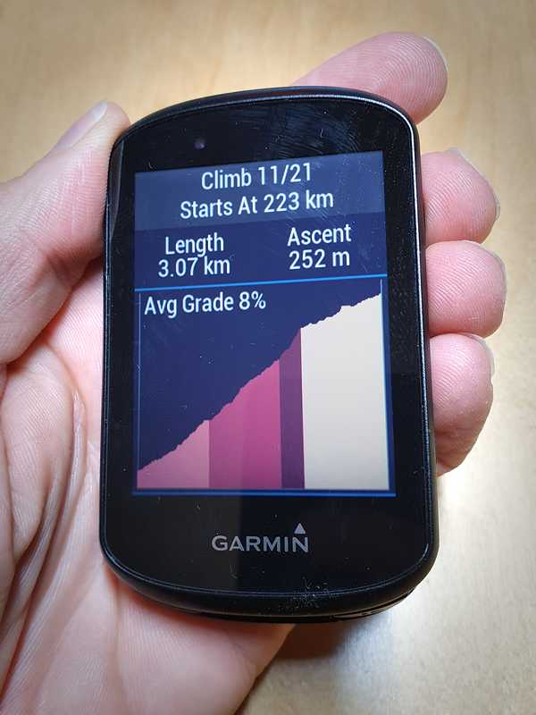
Part of the climb up to Björk in Hemavan, the finish for stage 1. This is on paper the toughest climb on the entire course, category 3, 251 meters of elevation over 3.1 km, 8.1% average gradient and the average for the steepest 200 meters is 16.5%. Once up, you are on the edge of the bare alpine mountain with a beautiful view.
Navigation
The event is not intended to be an orienteering challenge, instead you have a navigation device, typically in the form of a bike computer, in which you have pre-loaded the course. You are then guided by the navigator throughout the course and need not worry about finding your way.
Turn onto the crux behind Dajkanberg 84 km into the course, easy to miss if you don’t have the right navigator settings.
Due to the complexity of the course, the race places higher demands than most other races on the navigation file and the navigator settings. If you actually follow the advice given here it will work fine.
Most of the junctions where you have to make a turn are plain and obvious, but there are also a handful of places where you suddenly have to turn off a larger road onto a semi-overgrown road or path, and there are a few oddly shaped crossings that can be a bit difficult to interpret. In these situations, we know from experience that those who only have a GPS watch on their arm and/or lack a background map can take the wrong turn or miss a turn.
The most important thing is that the navigator gives a clear signal if you end up off course, so that if you happen to take a wrong turn or miss a turn, you can find your way back to the course again. If you have that and can accept a few occasional navigation mistakes, a simpler navigator will do.
For the best experience free from navigation errors, you should have a bike computer mounted on the handlebars (there are mounts for some GPS watches as well) with access to a background map that you either show all the time or switch to before crossings. In addition, one should use our navigation file with our hand-crafted notifications and set up the computer as we recommend in this section.
Files for navigation
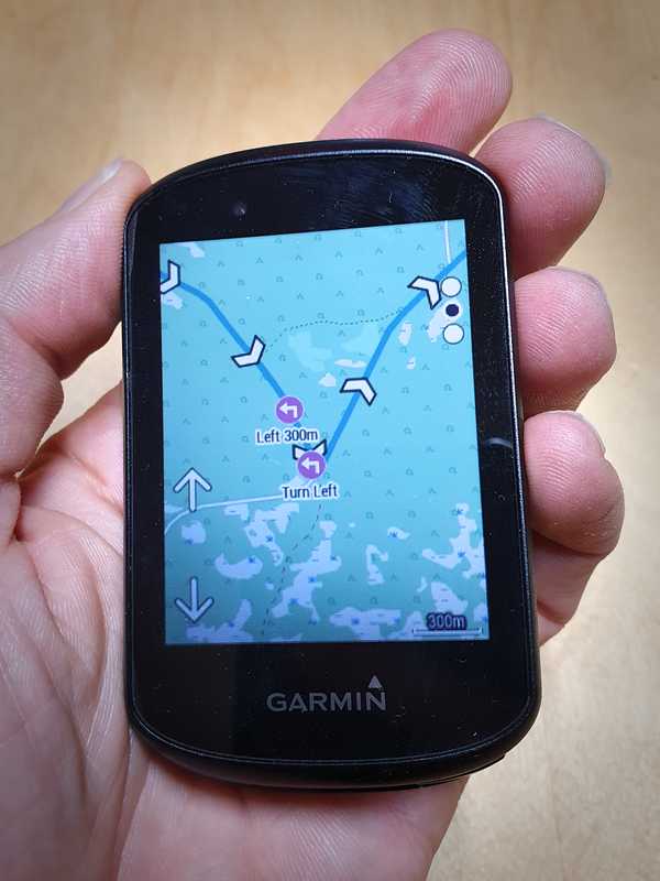
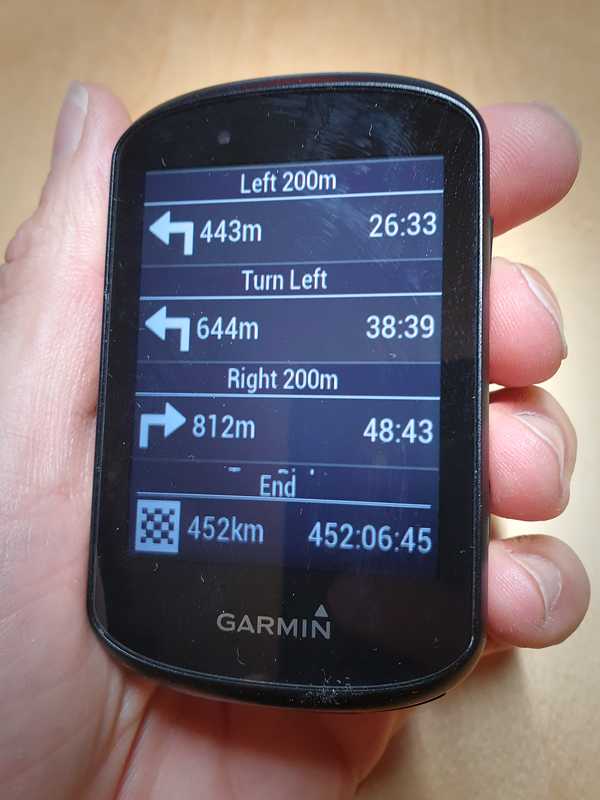
Official TCX file transferred to a Garmin Edge 530 and inspected in the device. If the transfer worked correctly, the notifications for all turns around the track should appear in the map, here “Left 300m” and “Turn Left”.
Simpler navigators, here represented by the Garmin Edge 130, lack a background map and only show the navigation file track on a blank background. This is the minimum level required. A background map will however reduce the risk of mistakes at single crossings with difficult to interpret shape.
Our navigation files in TCX format contain a contiguous track for the course and notifications before turns. A somewhat old-fashioned format, but it’s robust and supported by most navigators, old and new.
We don’t provide the course through Strava or any other online platform because we think the auto-generated turn notifications they make are not good enough.
At least Garmin navigators have a fairly low limit on how many notifications (messages before turns, etc.) a file with a course can have. Originally it may have been limited by the the actual hardware memory, but today it’s an artificial limitation which Garmin uses to differentiate its products.
To deal with these limitations we offer several different files so you can choose a split file or slimmed down version if your navigator has a smaller capacity.
The files for stage 1 end at Björk, and the files for stage 2 of course starts at the start of the stage 2, so the gap inbetween (inside Hemavan) is missing, but if you don’t sleep overnight there it must still be ridden as it’s included in the total.
The split day stage files are not split exactly in the middle in terms of distance, but in a place that means there won’t be more than 50 notifications per file.
To our knowledge, Garmin has three capacity levels: max 50 notifications (some watches), max 100 notifications (example: Edge 130), and max 200 notifications (example: Edge 530 and up, and some watches). These levels have been around for a long time and thus also applies to older models. Other makes may have other levels, and Garmin has been seen changing the capacity in some of their products through firmware updates.
The number of track points a course can contain is also limited, but according to our knowledge it’s at 10000 points or more for most navigators so there shouldn’t be a problem.
It’s usually not documented what capacity level one’s navigator has, so the best way is to try with the file you want to use, and only change if it complains about the capacity being exceeded.
Files with complete set of notifications, including extra turn warnings, and high resolution elevation data:
- storuman-gravel-xl-full.tcx — the full course, “SumGvl XL Full”, about 7800 trackpoints and 194 notifications (capacity level 200).
- storuman-gravel-xl-day1.tcx — day 1 stage “SumGvl XL Day 1”, about 3800 trackpoints and 94 notifications (capacity level 100).
- storuman-gravel-xl-day2.tcx — day 2 stage “SumGvl XL Day 2”, about 3900 trackpoints and 92 notifications (capaticy level 100).
- storuman-gravel-xl-d1-a.tcx & storuman-gravel-xl-d1-b.tcx — day stage 1 in two parts “SumGvl XL D1 A” and “SumGvl XL D1 B”, about 1700 + 2200 trackpoints and 45 + 49 notifications (capacity level 50).
- storuman-gravel-xl-d2-a.tcx & storuman-gravel-xl-d2-b.tcx — day 2 stage in two parts “SumGvl XL D2 A” and “SumGvl XL D2 B”, about 2500 + 1500 trackpoints and 48 + 44 notifications (capacity level 50).
Files with turn notifications but without extra warning ahead of them, as well as slightly lower resolution on the elevation data and the course track (but still good):
- storuman-gravel-xl-full-mini.tcx — the full course, “SGXL Full Mini”, about 4600 trackpoints and 100 notifications (capacity level 100).
- storuman-gravel-xl-day1-mini.tcx — day 1 stage “SGXL Day1 Mini”, about 2300 trackpoints and 50 notifications (capacity level 50).
- storuman-gravel-xl-day2-mini.tcx — day 2 stage “SGXL Day2 Mini”, about 2300 trackpoints and 45 notifications (capacity level 50).
Storberg, 94 km into the course.
If you have a bike computer with a low capacity, we recommend that you rather use two-part stage files, that is four files for the full course, than the lean files. But, maybe you prefer a less verbose notification or want avoid having to change files during the course of the event, and then the lean files fit better. If you actually keep track of when the next “course point” (notification) comes by looking at the screen from time to time, the extra warnings ahead of the turns aren’t necessary.
Many will split the event into two days, and also have a bike computer with sufficient capacity to handle 100 – 200 notifications, and then the day stage files with full notification is the natural choice.
If you are used to navigating long courses and want to build your own navigation file you can do that by importing our clean GPX files (stage 1, stage 2) to a platform of your liking, but for most it’s best to use our TCX files without modification.
If you build your own navigation file or do an automatic import via an online platform, be aware that it may be confused by the off-road sections or sections along roads it may lack in its map, or think that the country road is unsuitable for cycling, and could then alter the route without notice. So if you make your own file, compare it with our map to ensure that you really will follow the official course.
Notifications
Traditionally, the TCX format limits the notifications to only 10 characters, so the ones we use are indeed short, but on the other hand easy to read.
With Garmin and course points activated, you get this extra screen automatically, whether you want it or not, which shows the upcoming notifications / course points. Whether you actually use it or not is a matter of taste.
Notifications included in all files, even the lean ones:
- “Turn Left” and “Turn Right”, announced at the intersection.
- “Keep Left” and “Keep right”, clarifying notifications where you should continue on the same road, but it is not completely obvious which way that is. For example, ambiguities can arise when a side road joins in a curve and then these notifications are used. They come about 50 meters before the intersection. In the lean files some of these are removed, but the most important remain.
- “Crux 300m”, a crux (difficulty) starts in 300 meters, that is a passage that can be difficult to ride. There are only two such cruxes and both are about 1 km off-road tracks which are a little bumpy and overgrown. The entrance can be a bit hard to see because of the vegetation, so you have to be extra attentive, and this is mainly why the notification exists.
- “Gate 200m”, a gate or similar obstacle in 200 meters. These are found where there is a gate that is normally closed so you have to get off the bike and walk past, but of course you have to be prepared that closed gates might appear in other places too.
Supplementary notifications only found in the files with extra warnings before turns:
- “Left 200m” and “Right 200m”, comes as a warning before “Turn Left” and “Turn Right” 200 meters before the intersection. In a few cases these notifications also appear before “Keep Left” and “Keep Right”, but mostly not.
- Extra notifications before turns with 700 - 2100 meters distance are present in a few cases where the turn occurs in a high speed downhill section. The notification will then appear around the start of the downhill section, that is when the speed is lower.
- “2 x Turns” means that there will be two turns in a row that are so close to each other that there is no time to making an advance warning for each turn, so you need be extra attentive. Comes about 200 meters before the first turn.
To work well in practice with the limitations in precision and the delay you can expect from a typical navigator, the notification points in the file are about 50 meters before the actual positions.
(If you are curious and want to look at the TCX files in advance on your computer to see exactly where all the notifications are you can use the free software GPXSee. Be aware that you need to turn off "Eliminate GPS Outliers" in the settings, otherwise some data points are filtered out.)
Navigator settings
In order for you to have a good navigation experience, you must load our TCX file with notifications and elevation data intact, and enable the display of the TCX file’s “Course Points” . For most bike computers, it’s these things you need to consider:
- Choose file(s) that do not exceed the bike computer’s capacity in terms of number of notifications (course points) and track points.
- Load the track into the bike computer via cable directly from the computer, and not via Garmin Connect or any other platform (Strava, RWGPS etc).
- Activate “Course Points”, as the turn notifications are stored as course points.
For those of you who are Garmin users, there is a bonus section: tips for Garmin navigators showing how to properly set up a Garmin device for this event.
A final word of caution — if the navigator device complains about the track not matching its map or it starts suggesting to change the route so it matches the map, it can end in a faulty route which does not follow the course. You must ensure that the navigator’s own automatic routing, if it has such a feature, is disabled or at least doesn’t disturb or change the course.
On the way downhill from the quarry at Brattiken, 150 km into the course. The village of Forsmark and Hemberget in the background.
Thanks for reading all the way to here. All text below this line is a bonus and a curiosity for those interested, you miss nothing vital if you don’t read it.
More about navigation
Here follows a few less important but possibly interesting sections about navigation with our TCX files and TCX files in general.
Elevation data and timestamps
The elevation data in our files is of very high quality, so functions in the bike computer that require that will work well. Here Garmin ClimbPro showing the climb in Hemavan up to Björk, 223 km into the course.
Our TCX files contain elevation data of good quality, much better than what Garmin, Strava and other popular platforms offer. This means that you can trust that the elevation profile in the bike computer (if it has such a feature), and features like Garmin’s ClimbPro works well if you want to use that. This however requires that you transfer the file in such a way that the elevation data is preserved.
TCX files are in their basic form a recording of a training session or a race, and therefore they also have baked-in timestamps. The timestamps can be used by the bike computer to improve its guess on how long it will take to arrive to the next notification (course point). Garmin bike computers also have the function “Virtual Partner” which is simply a virtual cyclist to compare with, which moves according to the timestamps embedded in the TCX file.
Our TCX files are made for navigation and are not recordings of real bike rides, but instead designed from accurate map material. The embedded timestamps are then made with a mathematical model of a cyclist riding a bike at 21.5 km/h on flat ground, slower uphill and faster downhill. It takes this virtual cyclist 12 – 13 hours to ride a day stage. So if you for example plan to complete a day stage in 12 hours and gets passed by the virtual partner, you are behind schedule.
Problems with modern navigation workflows
Today’s navigator devices / bike computers have many advanced functions, but unfortunately it can still be a bit difficult getting them to behave in a good way with a pre-loaded long course on small roads. Using TCX files as we do here is certainly old fashioned, but is still the only way which works reliably and predictably over several different navigators, old and new and from different manufacturers. One have to live with that there will be simple text messages to indicate turns rather than graphic arrows in the map image.
When using a typical bike computer without configuring anything special and importing the course the usual way via Garmin Connect or other popular online platform, like Strava or Ride with GPS, it will not work very well:
- All turn notifications that is embedded in the file are removed and replaced with automatically generated, which on gravel roads in the north of Sweden means that it misses certain turns, gives notifications where there is no turn, and can give confusing notifications such as suggesting a U-turn along a plain stretch of curvy road.
- All elevation data contained in the file is replaced with the platform’s own elevation model which has such poor resolution in the north of Sweden that it often says it’s downhill when it’s uphill and vice versa, so any function in the bike computer that relates to the elevation profile becomes unusable.
Of course, you will still manage to get around the course if you employ the usual ways to import the course (via Strava, Garmin Connect etc), but the notifications you get, or the lack thereof, may cause some irritation when you are out on the course.
Tips for Garmin navigators
You can read Garmin’s own instructions how to manually load a TCX file via cable if you don’t know how already.
For those who choose to use the TCX files the way we recommend follows here suitable settings for a Garmin Edge 530 (other models have similar settings):
- Important: load the file via cable so that the notifications (and the elevation data) is kept intact.
-
Important: turn off auto-generated turn notifications
because they are of low quality and conflict with what
is embedded in the TCX file, and can also affect
the device’s power consumption and stability negatively.
- Menu → Navigation → Courses → Course Options → Turn Guidance [OFF]
-
Important: verify that the “course points” feature is
active
for the course (after the course has been transferred to the
device).
- Menu → Navigation → Courses → [SumGvl XL Day1/Day2] → Settings → Course Points [ON]
- To be sure, you can select “Map” in the same menu to display a map and there verify that there are small icons with turn notifications here and there in the course. If there is, the course was most likely transferred correctly to the device. If they are missing, the method of transfer have not kept the “course points” of the original file.
-
Normally you turn off ClimbPro in this part of the world
because Garmin’s elevation model is far too poor for
it to work at all. However, when you have loaded our
files via cable, the elevation data is good so ClimbPro
will work well. It’s still a somewhat intrusive feature that
takes over the entire screen when on a climb, and on at
least some Garmin models the turn notifications are delayed
if ClimbPro has just started, meaning there is a risk to
miss turns. Choose for yourself if you want it on or off, if
unsure, turn off.
- Menu → Settings → Activity Profiles → [Gravel] → Climb Pro [ON/OFF].
-
Configure a data screen suitable for viewing
TCX files’ “course points”: Menu → Settings
→ Activity Profiles → [Gravel] →
Data Screens → Add New →
Data Screen.
- Navigation → Course Pt. Distance — same as "Distance to Next", that is shows distance left to the next course point, but in addition to that a small icon is also displayed which shows the type of course point, such as a right arrow for a right turn.
- Several other fields may be of interest, such as estimated time to next point, elevation to next point and more, choose according to taste. However, the main field is “Course Pt. Distance”.
- If you often show the map screen, feel free to choose “Course Pt. Distance” as a visible data field on it.
- It may be useful to have the device’s battery percentage visible in a data field, so you can see how much is left until you need to charge.
- It’s (unfortunately) not possible to switch off the “Virtual Partner” feature on the 530 unit. The virtual partner will ride according to the timestamps found in the TCX file, and they are set to complete a day stage in 12 – 13 hours. On more recent units it’s possible to switch off Virtual Partner, which you probably will want.
- When course points are active, you automatically get one extra screen (no need to configure) that shows the next three course points.
Regarding map in the navigator, you should have one that is recent and based on OpenStreetMap. Garmin’s own “TopoActive” is that, so as long as you have updated recently you have a great map. If you have an older unit where TopoActive isn’t included, like the 530 used in our example, there are good free maps like Freizeitkarte, which are installed manually. We actively contribute to OpenStreetMap along the course, and usually add more detail each year, thus it’s nice to have a map which is as recent as possible.
Tärnamo towards Stor-Björkvattnet, view when you look to the right in the climb towards Blomstervallen 201 km into the course.
How tough is the time limit?
You have from 06:00 on Saturday until 22:00 on Sunday to get from start to finish, that is 40 hours. Many participants will want to get an overnight stay and several breaks in that time though.
Let’s assume that you stay overnight and start at 06:00 also on day two, then you have 16 hours before the clock strikes 22:00. Most will want a proper lunch break and other breaks when riding for so long, so maybe a total of three hours standing still, then we have 13 hours left to ride. Both day stages are quite similar in terms of distance and elevation gain, so let’s calculate the total — in 26 hours of active riding you should cover 450 kilometers. Then you have to ride at 17.4 km/h on average.
Gardikforsdammen, 153 km into the course.
For a fit amateur 17.4 km/h doesn’t sound like much, and it’s not, even on gravel. However, the course is not without hills, and you lose more time uphill than you regain downhill. To compensate to some extent, most people push a bit harder uphill, so let’s say you produce 35% more power for up to 20 minutes straight when it’s uphill. If we apply that model to the entire course with all hills, we come to the conclusion that you need to maintain at least 21.5 km/h on a flat gravel road (assuming no wind), then the average over the entire course will end up at exactly 17.4 km/h. In order to last the whole course and to be able to push a little extra on the uphills as the model expects, those 21.5 km/h must be at a comfortable speed that feels like you can keep almost forever.
If you want to have more time to complete the ride, it can be achieved by making a shorter overnight stay, or no overnight stay at all and instead just take shorter rests here and there all the way around the course.
A few summarized time examples calculated according to the model described above:
- Riding 06:00 – 14:00 with half hour pause → 7½ hours active cycling per day → 30,2 km/h on average → 32,7 km/h on the flats.
- Riding 06:00 – 16:00 with one hour pause → 9 hours active cycling per day → 25,2 km/h on average → 28,3 km/h on the flats.
- Riding 06:00 – 18:00 with one hour pause → 11 hours active cycling per day → 20,6 km/h on average → 24,4 km/h on the flats.
- Riding 06:00 – 20:00 with one hour pause → 13 hours active cycling per day → 17,4 km/h on average → 21,5 km/h on the flats.
- Riding 06:00 – 22:00 with one hour pause → 15 hours active cycling per day → 15,1 km/h on average → 19,4 km/h on the flats.
- Riding all in one go with 8 hours rest in total → 32 hours active cycling → 14,2 km/h on average → 18,5 km/h on the flats.
So overall, you can say that from an amateur’s perspective the time limit is quite tough. There are two reasons for that, we as organizers want the event to have a sporty feel, and we also want to complete it in a weekend.
The downside is that it’s a bit unwelcoming to slower cyclists or those who want to take it very easy. At normal bike packing pace with camping equipment brought on the bike, this course would probably take five days rather than two to complete. However, there is nothing that prevents you from ignoring the time limit, and if you fail to make the limit but still complete the course, your time will be published, although it doesn’t count as a completed event.
Keep in mind that although the average speed in these calculations can seem easy in relation to a four-hour training session, a significant challenge in this type of event is to keep the body going for a long time and manage to replenish with nutrition continuously. What feels like an easy pace the first four hours can be hard to keep eight hours in, especially if you get problems with your nutritional intake.
Tips about equipment and packing
If you have not done this type of event before, it can be a challenge to pack the bike with everything you need. This section is intended to give some tips and inspiration for how the equipment and packing can look.
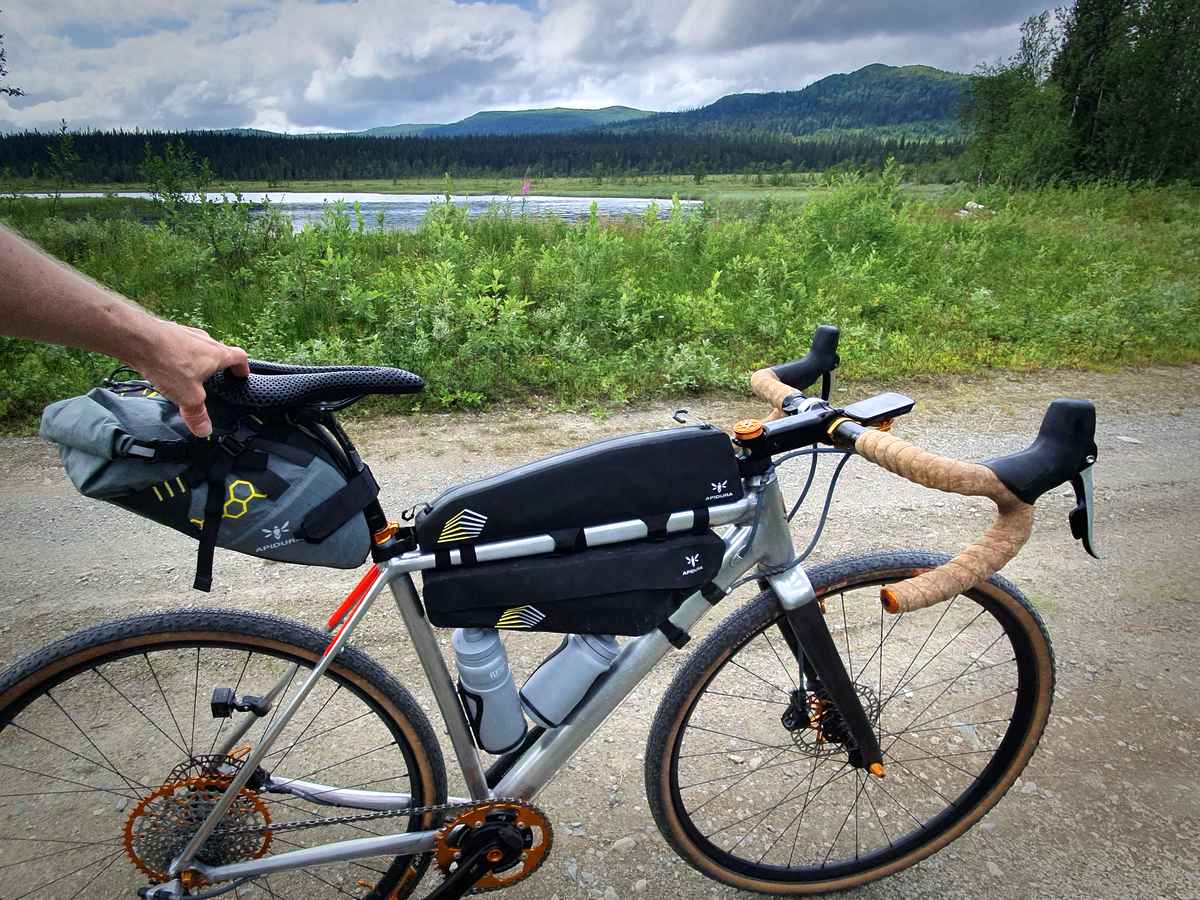
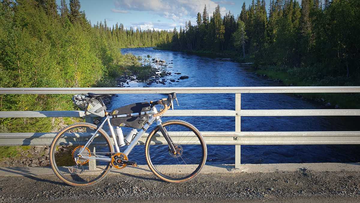
Example of bike equipped for Storuman Gravel XL. Saddle pack, long top tube pack, half frame pack, 750 + 500 ml water bottles in bottle cage with side entry. Reflectors via reflective tape on the frame, rear light mounted on the seatstay. Bike computer/navigator in outfront mount (picture taken at Kroksjön 127 km into the course).
Swedish law actually requires reflectors and lights on the bike only if you ride in the dark, so racing bikes often lack that. However, in ultra-distance cycling, reflectors and lights is standard equipment, because even if you don’t intend to ride through the night you can run into delays and end up in the dark anyway. If you are a bike geek and think cheap plastic reflectors are ugly and heavy, reflective tape can be used.
When it comes to bike bags to bring a bit more gear than usual there is nowadays a plethora to choose from, thanks to the rise of the bikepacking culture.
Almost everyone chooses some type of large saddle pack, which is good for packing bulky items such as clothes, and the size can be adjusted by the protruding part being rolled up like a drybag. It often obscures the rear light, so you may have to mount the light on the bag or a seatstay instead.
Gravel roads can be transformed by weather and their maintenance cycle. Here is an example of a piece of road 21 km into the course which at the time of the photo had just received a new wear layer in the form of coarser gravel. Normally this is the coarsest gravel to be encountered along the course.
To access things while riding, usually carb-filled snacks, most people also choose some kind of top tube pack. For extra packing space, you can add a frame pack under the top tube as well. These are good for fast cycling as they don’t add significant drag, but as they are narrow you can’t pack bulky items in them.
If you want you can bring full camping equipment including tent and sleeping bag on the bike, but as the time limit is quite tough it means that it will be a rather stressful bikepacking trip. Therefore we expect that most participants will not carry full camping gear, but rather use the available accomodation options in Hemavan.
If you haven’t participated in this type of event before, you may be surprised over the amount of carbohydrates that you need to transport on the bike. Also consider that the amount of clothing needed can vary quite a lot and change with short notice depending on the weather forecast. Plan your packing and test pack well in advance so you really know you have the space you need.
A typical packing for the event weighs 3 – 4 kg, so most people will need more than just a saddle pack. The bike pictured above has a saddle pack, a long top tube pack and a half frame pack. It is test-packed for the event and illustrates well how a bike could look on the starting line.
Other popular packs used in this event is hydration backpacks (which also may have som packing space) and handlebar packs.
Aerobars
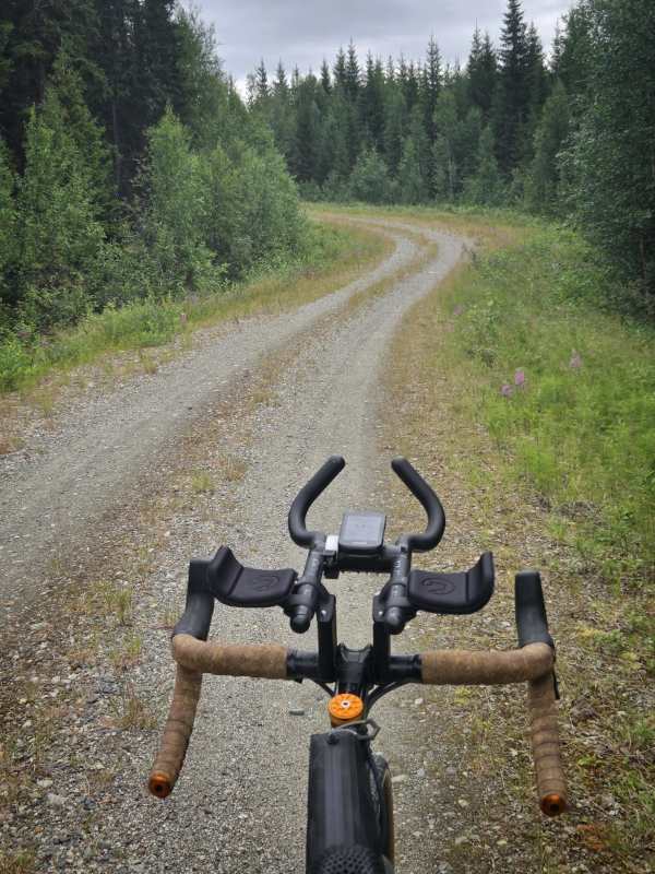
Aerobars with mounting adapted for ultra-distance. The armrests are relatively wide apart and mounted just behind the dropbar, 7 cm high spacers, bars with a bent end for a comfortable hand position with a neutral wrist. The bridge with the bike computer is homemade from a piece of plastic pipe. The photo is from the hill up towards Kaskeluoktliden, 384 km into the course.
It’s popular to use aerobars on ultra-distance and randonnée events, and several participants in Storuman Gravel XL do so. Aerobars are actually made for time-trials, that is short fast races, but by mounting them high and far back, it provides a comfortable position suitable for long distances. The hands are completely relieved, while the back and neck experience approximately the same position as when you have your hands in the drops. A small aerodynamic advantage remains despite the high mounting by obtaining a narrower profile. Access to the brakes (usually also the shifting) is missing from the aerobars, so it is only used on easy-to-ride, predictable sections.
If you tend to have problems with your hands on longer rides, it may be worth trying aerobars, even if you are not interested in the aerodynamic advantage. Since aerobars are narrow, it may be difficult for beginners to keep a straight line, but it does not really feel wobbly.
Not all aerobars sold are suitable for ultra-distance. You need high spacers to raise the handlebars, preferably 5 – 7 cm (often sold separately), the armrests need to be able to be mounted relatively wide and far back. The bars themselves should have a shape that provides a comfortable hand position without angulating the wrist, that is not with nearly horizontal ends, instead a J-bend or similar. Also keep in mind that it should be able to be mounted on the dropbar you have and then provide suitable span between the aerobars.
To be able to attach a bike computer and light between the bars, a popular method is to make a homemade bridge from a piece of plastic pipe and attach it with cable ties or tape. You can wrap the ends of the bars with handlebar tape, but many choose to leave them unwrapped.
Nutrition
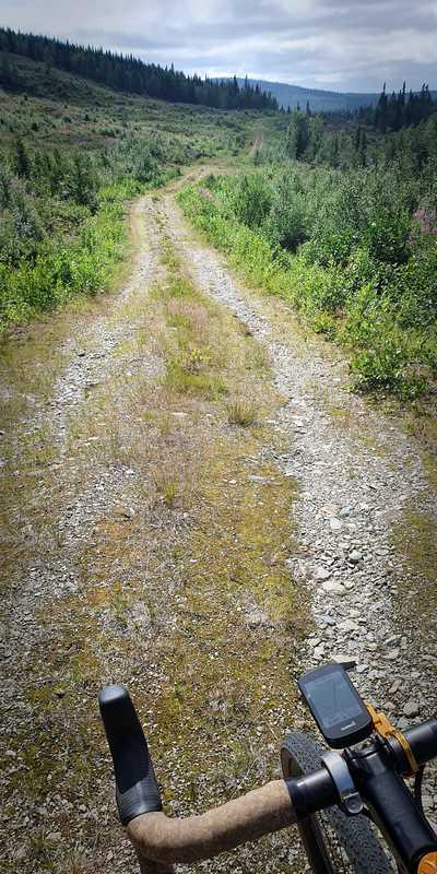
Behind Silverberget, 109 km into the course. This 3 km long passage is behind road barriers and can thus not be reached by car.
An ultra-distance event can sometimes jokingly be called an eating contest with some cycling in between. It alludes to the fact that when the body works for such a long time, a central part of the performance becomes how well one succeeds in filling up with new energy during the course of the event.
If you are used to participating in this type of event, you already have a developed nutritional strategy (which can be highly personal). The text is primarily aimed at those who have not participated in such a long event before, when the central role of nutritional intake may come as a surprise.
For being an ultra-distance event Storuman Gravel XL is short, so you are not faced with as tough a challenge when it comes to nutrition as an event that goes on for many days. On the other hand, the short time limit requires you to be active for a large part of the day, which makes the nutritional intake a challenge still. In addition, the possibility to use shops and restaurants is limited, but there is a grocery store in Hemavan which is (normally) open 9 – 21, and a few restaurants that normally close at 19:00. (In Slussfors there is also a small unmanned store with a simpler grocery selection and less certain open hours, it’s best seen as a bonus than to plan for using it to replenish.)
If you intend to stock up in the grocery store, you cannot be too picky about which specific products that should be available. You must be able to adapt to the range the store has. In addition, you have to think through the case that you do not make it in time, if you for example are unlucky with bike breakdowns. Also keep in mind that finishing back in Storuman may take place outside the local businesses’ opening hours, so make sure to prepare with access to food for recovery immediately after finishing.
How many calories do you burn during the event? For a typical rider, the effort will consist of approximately 2 × 12 hours of cycling at a fairly leisurely pace with up to 12 hours of rest between stages. A person who weighs 75 kg then burns about 600 kcal per hour cycling (and about 75 kcal/h at rest). It will thus be 600 × 12 = 7200 kcal cycling per day stage. It’s impossible for the body to absorb the corresponding amount of nutrition while cycling, so one is on a lower intake and the rest of the energy comes from the body’s reserves.
On the way out from the village Jokksjaure 264 km into the course. The mountain Joksgaejsie rises up in the background and covers the higher Ryfjället behind.
A general recommendation is to try to take in 30 – 60 grams (120 – 240 kcal) of carbohydrates per hour during cycling, if you have an iron stomach even more. More than 60 grams requires technical supplements such as gels and sports drinks with two different carbohydrate forms to maximize absorption. As long as the body can absorb the carbs, more is better, you can handle higher intensity for longer and recover faster afterwards. The trend has thus gone towards ever greater carb intake and today the elite can eat 90 – 120 grams, but they work at very high power output and intensity. If a recreational cyclist attempts that level of consumption, a large part of the carbs will likely remain in the stomach and intestines instead of being absorbed by the body, and cause stomach problems a bit into the ride. As a beginner and recreational cyclist, it’s more realistic to stick to 30 - 60 grams. Since one works at a lower intensity and than the elite, the deficit will not necessarily be greater.
With lower intensity out on the course, the margins increase. It’s easier for the body to continue work despite a deficit, that is use the body’s fat reserves, and there is also less risk of stomach troubles when you eat while riding. Anyone who intends to ride the entire course in one go near the top of their ability will need to have good knowledge of which nutritional strategy is best for their body. Those who split the event into two days and take it bit more easy don’t need to be quite as concerned about optimizing their nutritional intake. It also works better to mix in slower forms of energy such as fat and protein, so you can vary your diet more and eat a larger proportion of regular food.
If you want a sporty nutritional plan, you have to focus more on maintaining a steady supply of carbohydrates throughout. Among recreational cyclists, it’s common that the recommended base level of 30 - 60 grams is still significantly higher than one is used to. You can finish the event even with a low intake, but if you are looking for a quick time, many will benefit from eating more than usual.
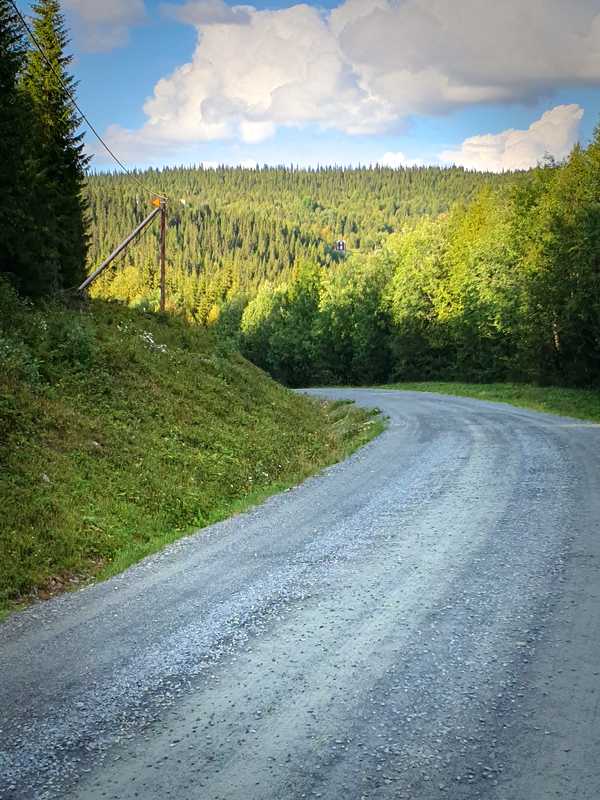
At the top of a tough climb in the curve towards Storskog, 286 km into the course.
Gels are perhaps the most practical carbohydrate supplement and the easiest to dose. However, due to the water content, they can take up quite a lot of space in the packing. Sports drinks (in powder form) is most efficient in terms of space and weight, but as it’s linked to water it can be a bit trickier to manage. Some can consume only gels and/or sports drinks for a whole day, but far from all. You can have problems with your appetite if you don’t mix it up with other things. Gels and sports drinks are also expensive for what they are (maltodextrin + fructose + salt + flavorings), so if you use a lot it may be worth making your own. There are recipes to be found online for those interested.
Regardless of which strategy you choose, it’s important to test your nutrition plan during training so you know how the body will react. It may not be practical to carry out 12-hour sessions during training, but an occasional 6-8-hour session should give a pretty good feel for whether the plan will work.
Water access
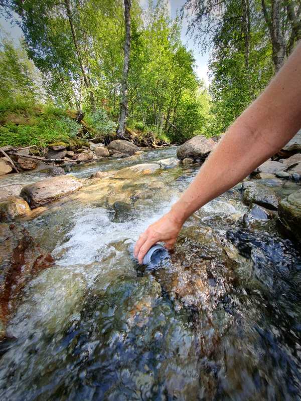
Refilling of water bottles next to the road, probably at an unnamed smaller stream below Sleaberget about 240 km into the course. There are plenty of streams to fill up water from. The larger ones that run under bridges are easiest to spot in advance, but often a bit tricky to get down to. Semi-small streams that flow through larger road culverts are usually the easiest to use.
How much water you drink depends to a large extent on how much you sweat, of course. On a cool day, as little as 300 ml per hour may be enough for some, and on a hot day, some may need more than one liter per hour (then you should also reinforce with electrolyte supplements). For this course, one liter of water on the bike is normally enough. If the weather is hot or you are one of those who sweat a bit more, you may want 1.5 liters or more.
With a liter on the bike and half a liter consumption per hour, you need to fill up every two hours, or approximately every 40 km. If you study the map, you will find plenty of small streams that cross under the road. The smallest go in culverts and sometimes they are so small that they don’t flow, but more often the problem is that you don’t see them from the road.
To make it simple and reliable, let’s just count the obvious water sources — streams big enough that the road has a bridge with railings or at least clearly visible from the bike, and lakes in places where the water’s edge is right next to the road and it’s easy to get down to it. For most of the course there is less than 20 km between such places. However, there are some sections where the water is a little more difficult to reach:
- 90 – 134 km (44 km) from Harrvikbäcken to Holmträskbäcken. You can access lake Skansnässjön at Sjöberg around 115 km by cycling down to the beach where boats are kept.
- 157 – 194 km (37 km) from Stensjöån to Stor-Björkvattnet’s shore. Only minor streams, difficult to see from the road.
- 299 – 328 km (29 km) from Girjesån at the outlet of Nedre Boksjön to the shore of Sparmanselet. You ride near water in many places, but it’s usually difficult to get to the water’s edge.
- 366 – 403 km (37 km) from Nipen to Harrbäcken. No obvious major stream to refill from, but you pass close to lake Volvosjön at 378 km.
It can thus be wise to top up the bottles even if you have plenty water left when you get to the last water source before one of these sections, but it’s not absolutely necessary, it will work out anyway. To get down to the water’s edge, you often have to go down a steep slope and/or walk on boulders, so choose cycling shoes with good grip.
Inside Hemavan you can stop at Hemavans Fjällcenter and refill at the water station, see the map for Hemavans Fjällcenter & Camping.
Unnamed wetland, 329 km into the course.